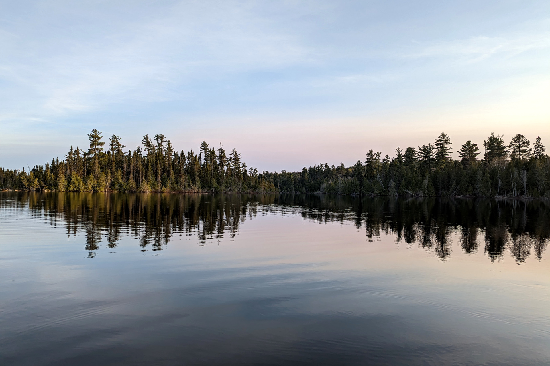
Location: Ranger Lake, Aubinadong-Nushatogaini Rivers Provincial Park, Algoma Headwaters Provincial Park
Date: May, 2023
Duration: 9 days
I had a tough time deciding on a destination for my spring backcountry trout fishing trip this year. I knew I wanted something different – away from busier operating provincial parks, somewhere less travelled, with more unknowns and more of a challenge. Of course, it also needed to have opportunities for trout.
My ideal route has a mixture of both river and lake travel, with portages that aren’t exceedingly long (at least, individually) – *ahem*, Algonquin’s Dickson Bonfield portage… Having whittled the list down to a small handful of locations, it wasn’t until the beginning of May that I finally settled on the Ranger Lake area in Algoma.
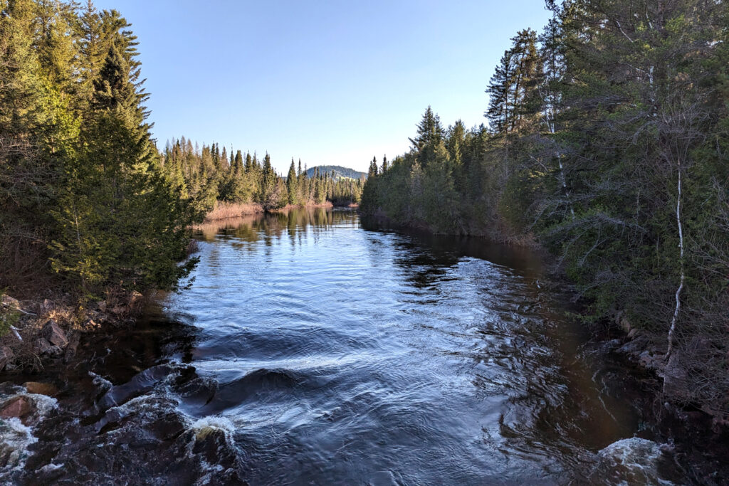
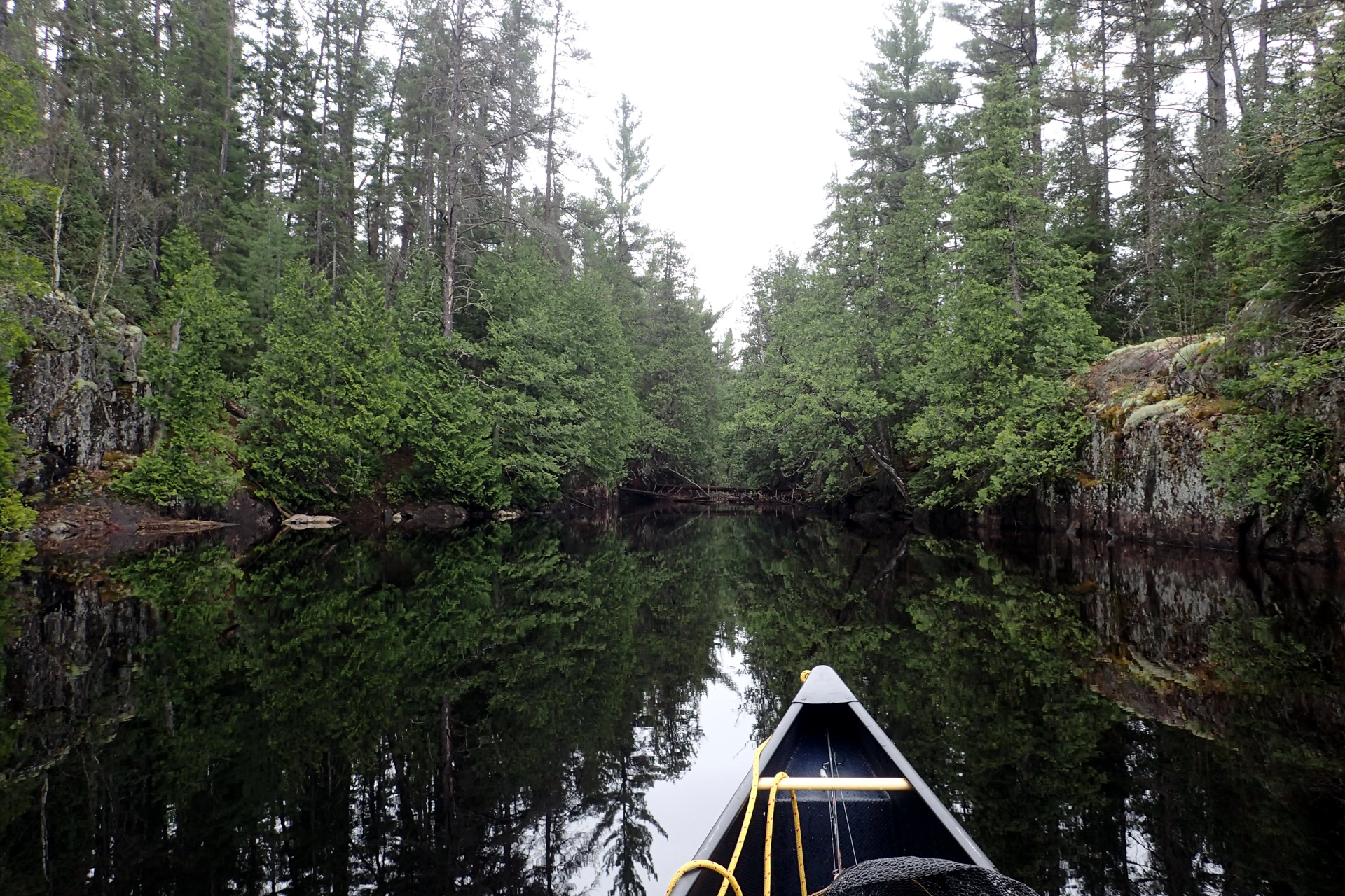
This route, which starts at Ranger Lake, can be done as a loop, paddling first through a series of lakes, then upstream on either the West Aubinadong or the Nushatogaini River, then across and back down the other river. It enters the non-operating Algoma Headwaters provincial park in the northern sections of the rivers and lakes.
The route itself is not frequently travelled, though it’s seen a minor spike in popularity in recent years, in large part thanks to Kevin Callan documenting the route in his book Lost Canoe Routes – as well as a few others documenting their travels here. By minor spike in popularity, I’m talking about most likely only a small handful of people who paddle the route each year.
I decided not to do the full loop for this trip, largely because the Nushatogaini didn’t appeal to me as much from a fishing standpoint, but also because there are both very limited camping opportunities on that river and I was bringing my Nova Craft Blue Steel (50/50 Aramid/Carbon) canoe. Although this canoe is quite durable for a light weight canoe, it’s not the best for dragging over rocks or paddling in conditions where it’s likely to take a beating – which, as I understand it, the Nushatogaini often is due to its lower water.
This was another solo trip, which I allocated 10 days for. Starting at Ranger Lake, my planned route would include almost 100km of paddling (a lot of it upstream) and about 12km of portaging, factoring in double carries. Although 12km of portaging doesn’t sound like much, when you consider it’s over almost 40 portages, many of which are somewhat rugged, poorly maintained and not marked, it’s a serious effort! That said, I logged slightly less distance and days than this, due to a slight set back – which I’ll go into later.
Day 1: Forest Roads, a Friendly Encounter and Headwinds
I drove 8 hours from my home to Ranger Lake on a Friday evening, arriving at the access point around 1 am. After sleeping in the truck and waking at 6 am, I took an exploratory drive down some forest roads to attempt to cut some tedious big lake paddling off my trip – hoping to begin my trip as far in as Gong Lake. If I could manage this, it would give me much more time to fish and relax.
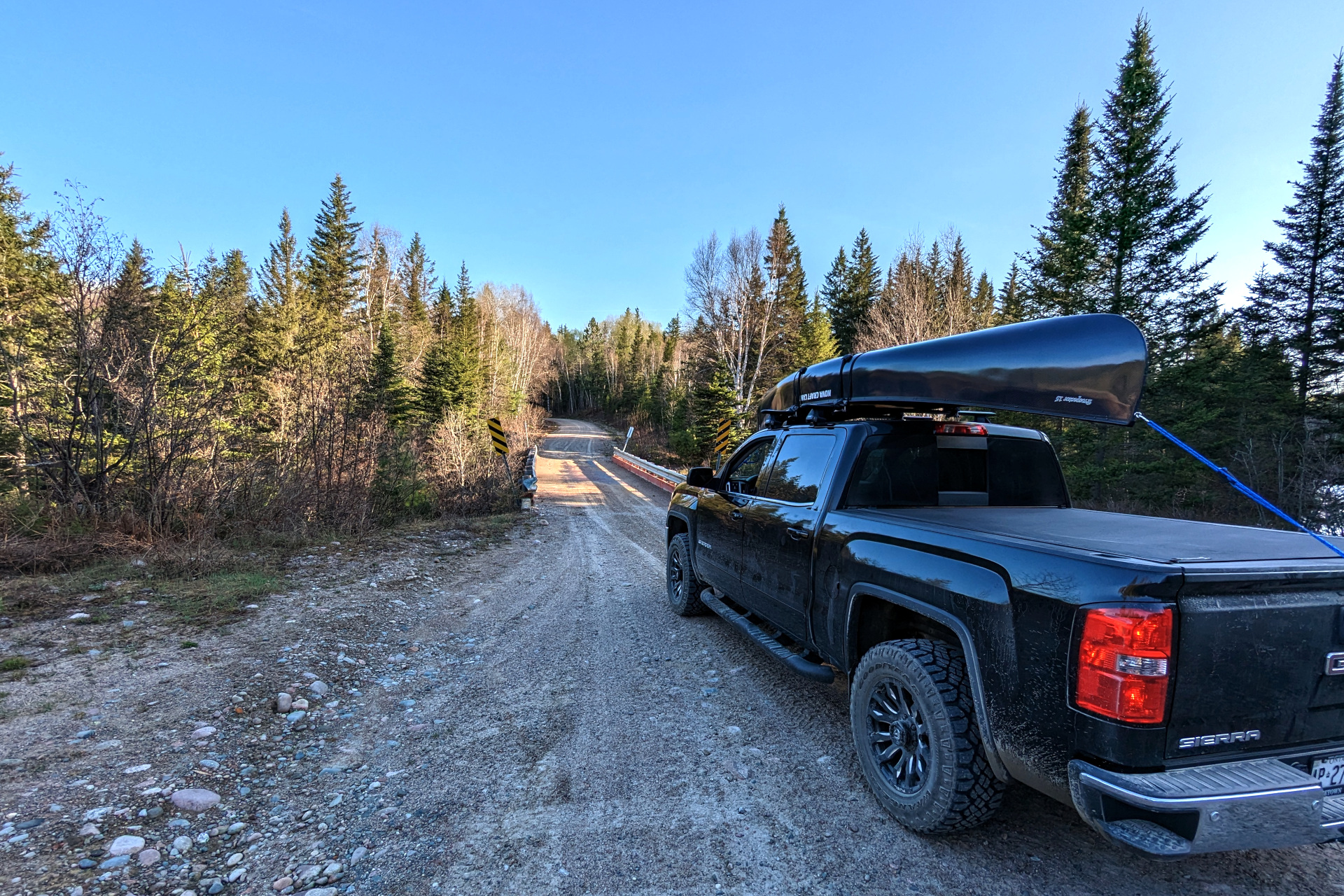
I didn’t get to look at much on the drive up the night before, since it was pitch dark. So, I was glad to get the opportunity this morning to drive over what seemed like countless bridges, each crossing a mysterious river that managed to evoke my sense of wanderlust.
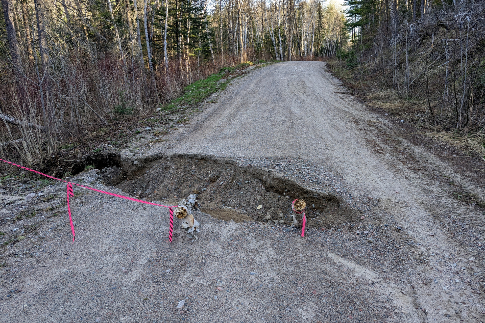
Eventually the forest roads became rough enough, and slow enough going that I decided to give up, turn around and head back to the Ranger Lake access point. There were several good sized washouts, but equally as concerning, Blind River was the last open gas station I filled up at the night before – and I hadn’t brought any extra gas with me. The last thing I needed was to get stuck or run out of gas on my way back out.
It was about 10 am by the time I got back to Ranger Lake and was ready to set off north.
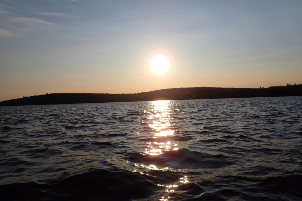
There was a moderate headwind, like there always seems to be when starting a trip.
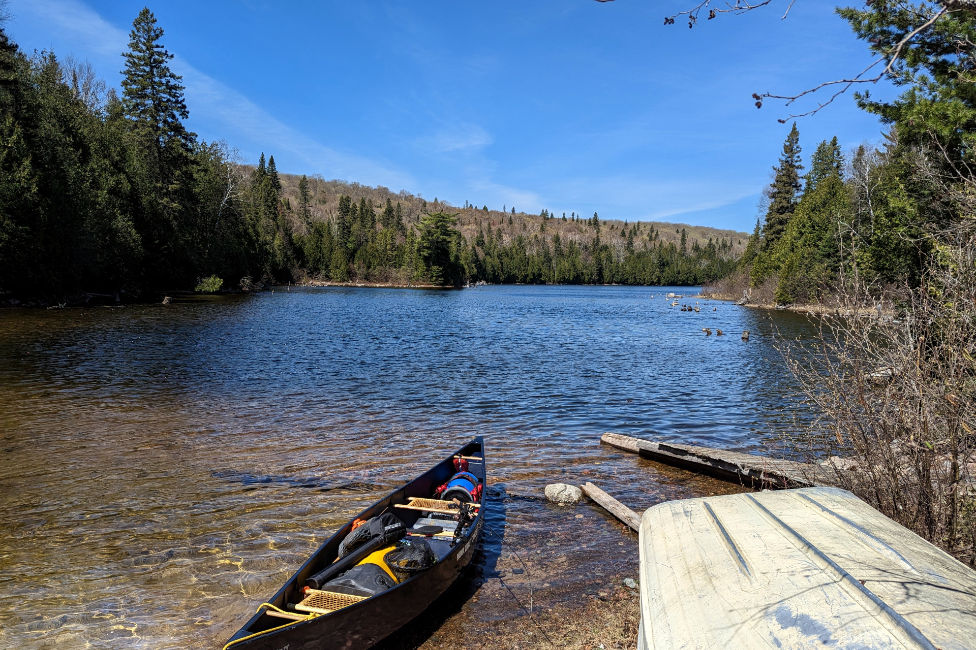
It was around an hour paddle to the northern tip of Ranger Lake, where the portage was. There’s an old lodge on the property here and I’d read from other trip reports that the portage was right at the lodge itself. I paddled around for a bit looking for it, but it wasn’t obvious where the take-out was. A couple guys were working on the property and I certainly didn’t want to trespass.
As I paddled in front of the lodge looking for the portage, one of the guys hollered over and pointed me to the take-out – which is on the left side of the property, beside the boat house.
After unloading my canoe and gear, I ended up chatting with the property owners – three super nice fellows from Michigan. Not only did they offer to help me with my gear (which I graciously declined), they also offered me some hotdogs that they just finished grilling. I graciously declined again, but was easily swayed to join them for a quick lunch. We sat, ate and talked for around 15-20 minutes, and I was extremely grateful for the food, conversation and generosity.
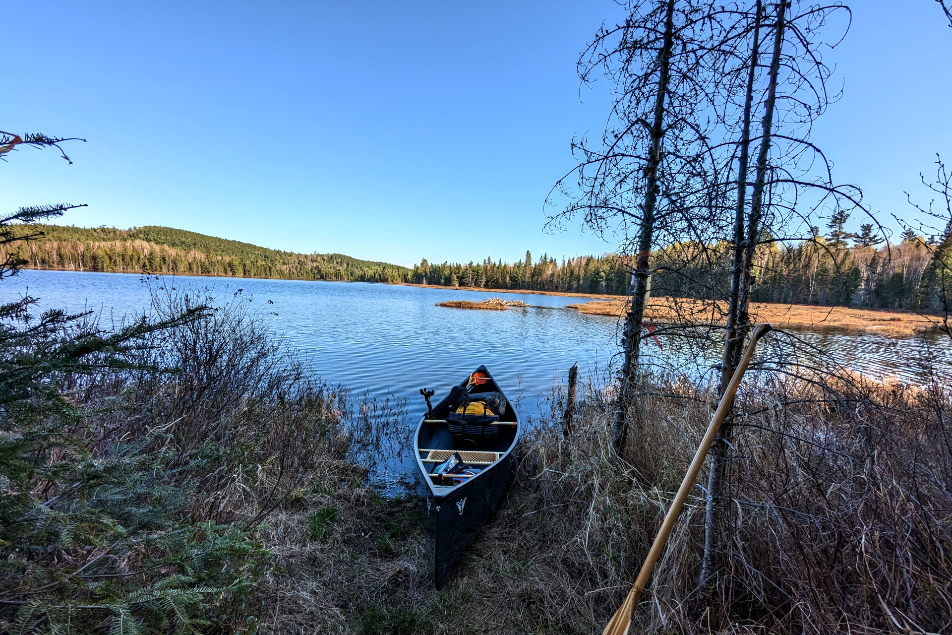
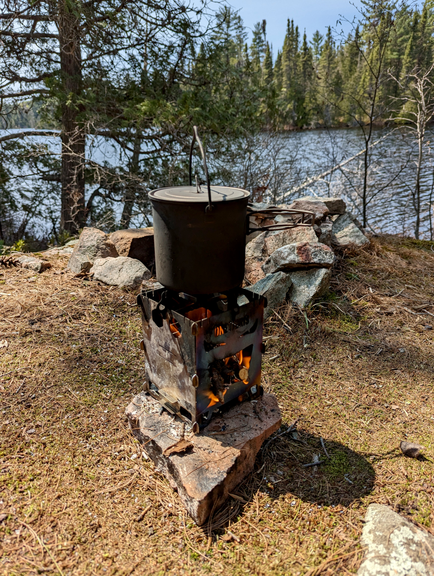
After lunch, I completed my first portage of the season – an easy 200m trail that let me tweak my double carry strategy and break me in for the 30+ portages to follow. It’s worth mentioning that I made a conscious decision to not travel light this trip. Cold weather meant the need for warmer/bulkier clothes, 10 days meant a lot of food, and a fishing trip means you don’t really want to skimp (too much) on fishing gear. So, I committed myself to double carrying every portage on the trip.
Once at Saymo Lake, I messed with my gear a bit more, setup my fishing rod (not sure why I hadn’t done this back at the truck) and set off on Saymo Lake at around 12:50 pm.
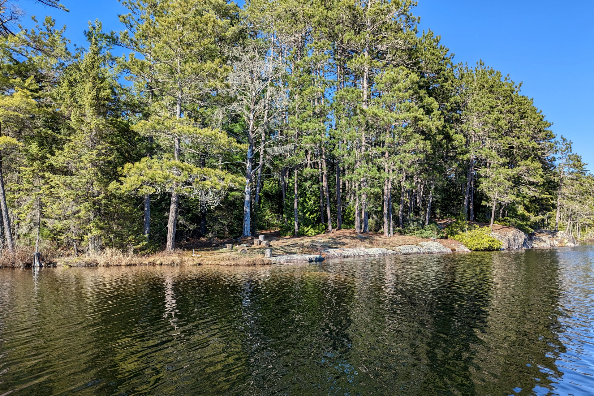
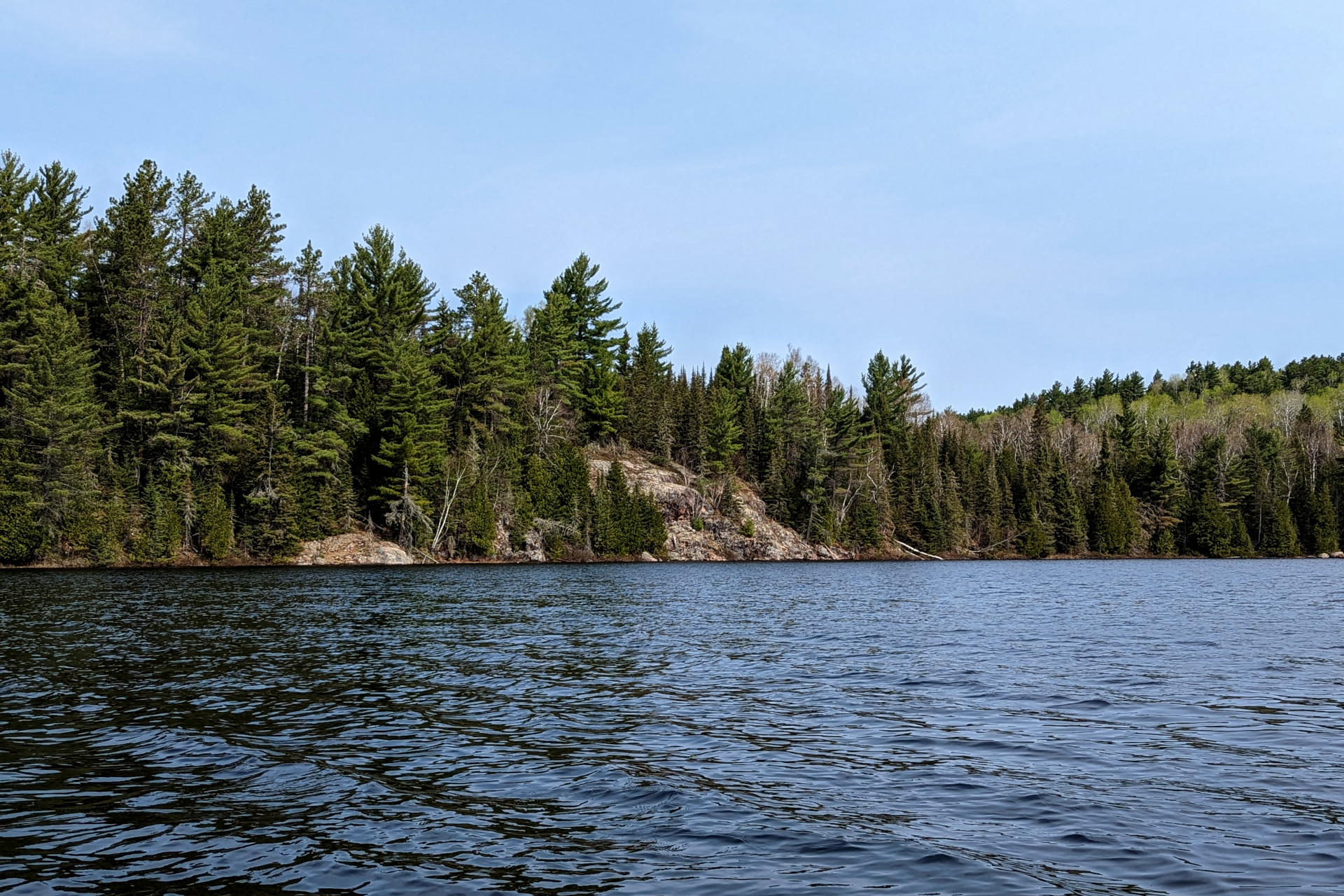
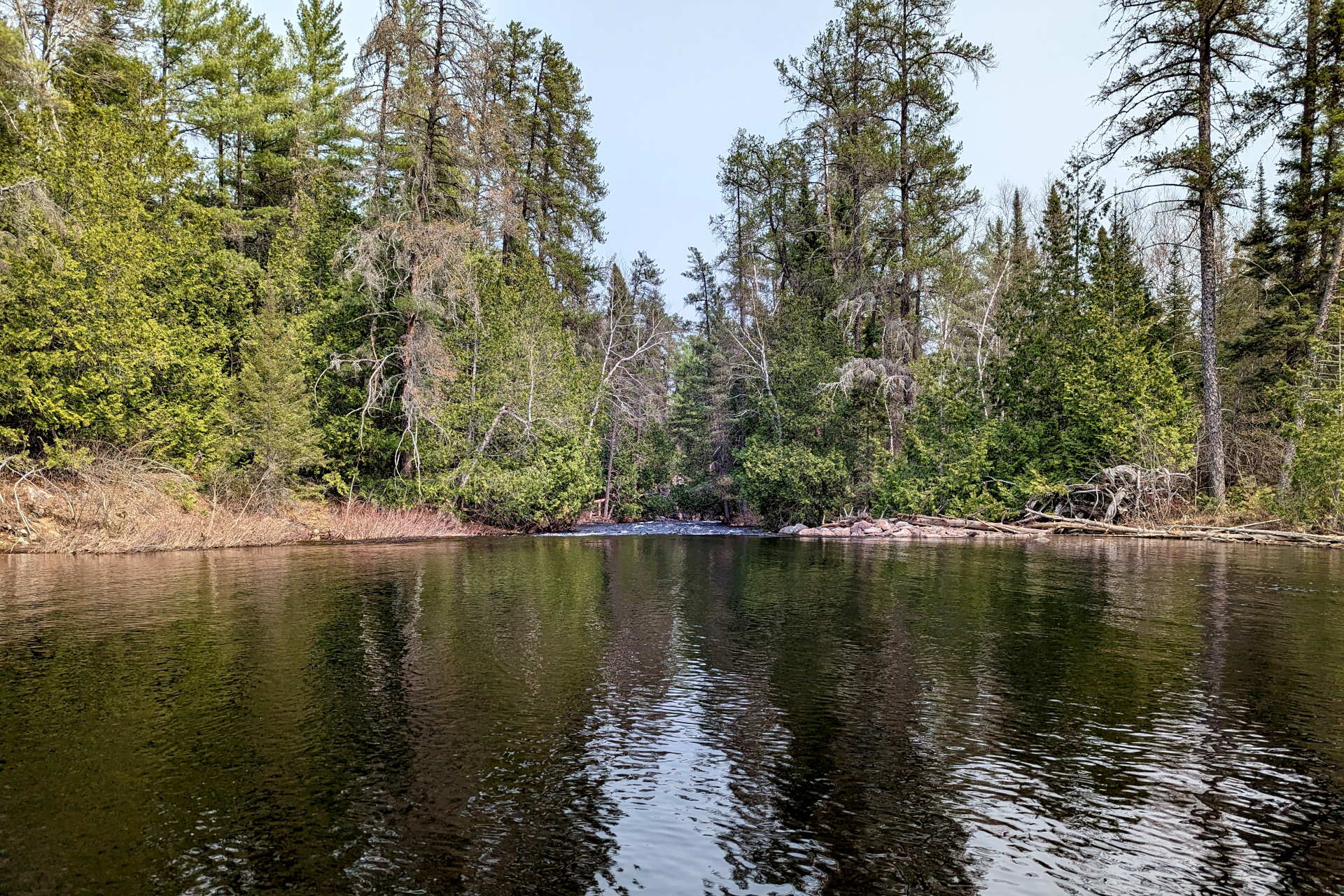
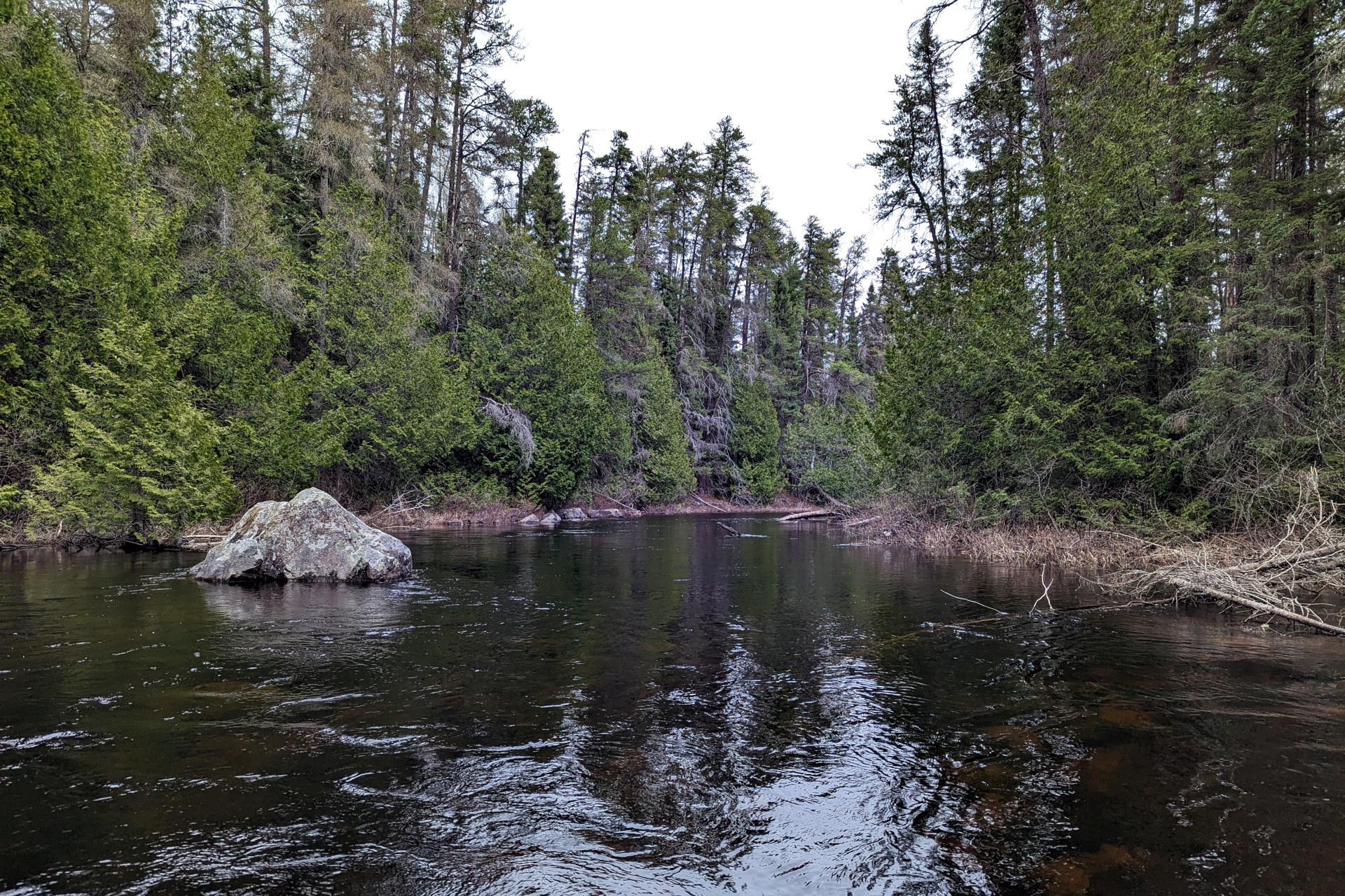
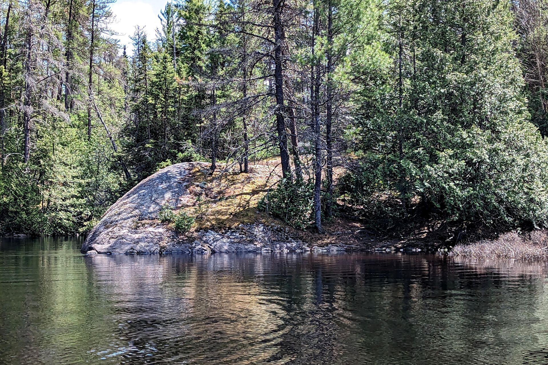
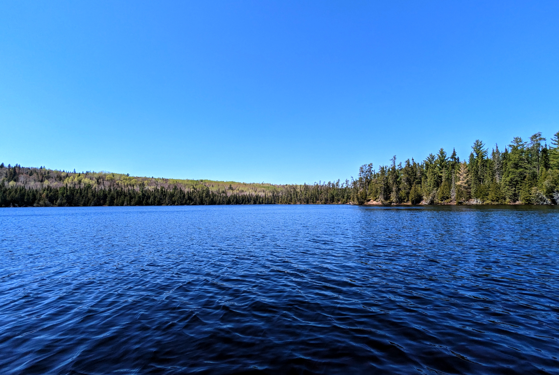
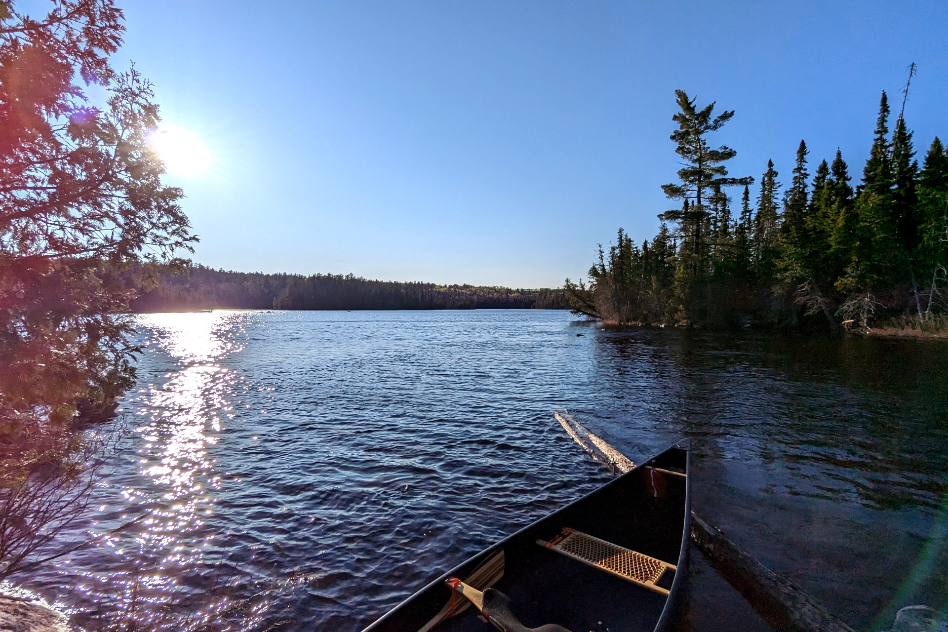
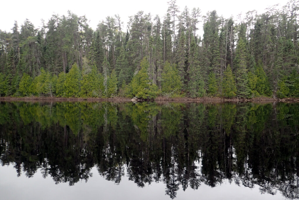
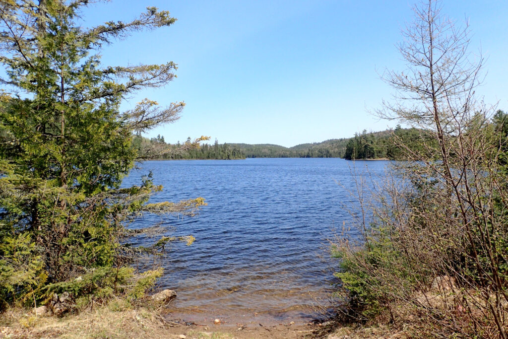
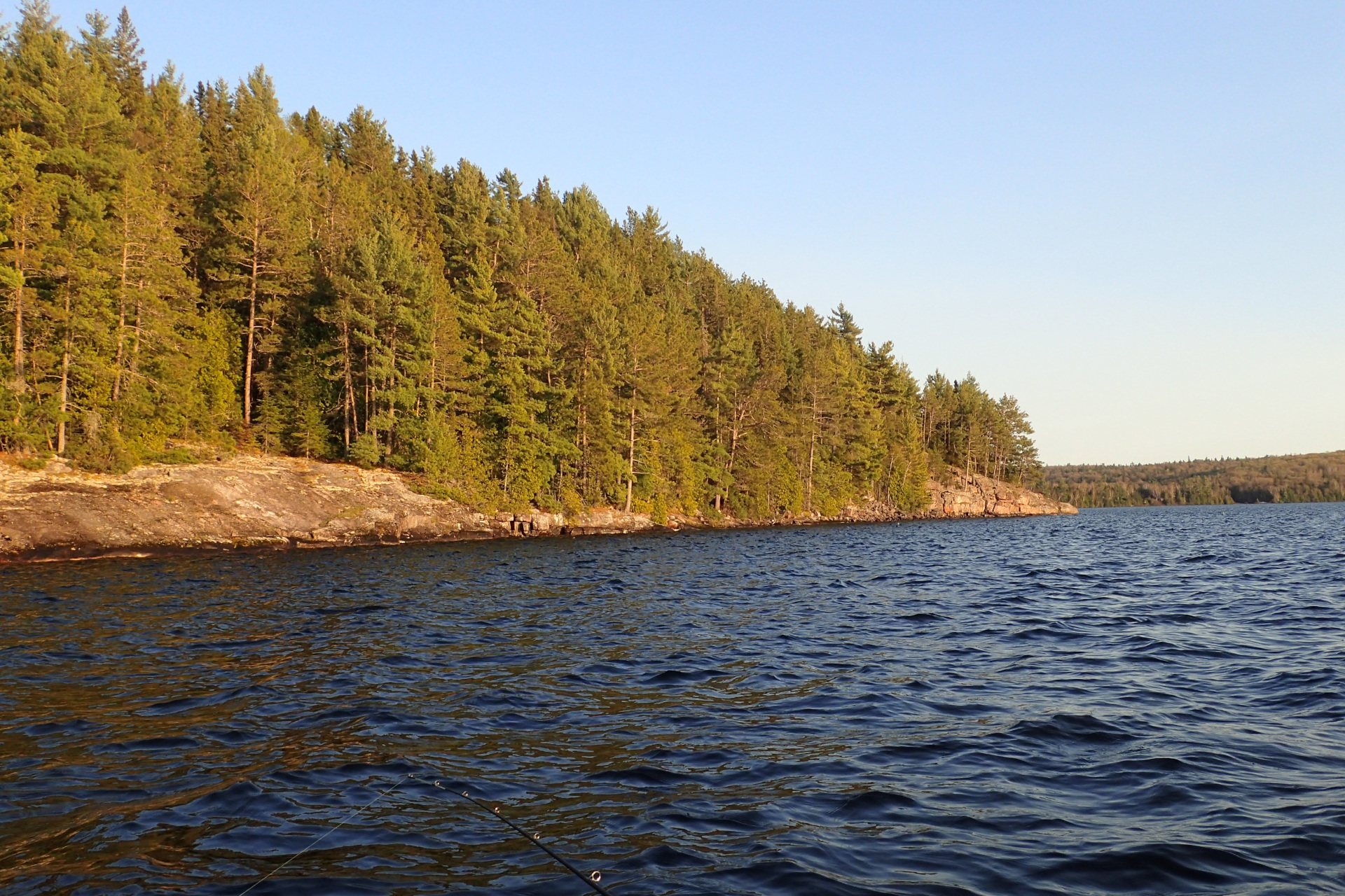
Saymo was certainly an interesting lake. Fairly long and narrow, with several islands and nice campsites. Quiet enough to assumingly keep most motor boats off it, thanks to the Ranger Lake portage. Also, deceiving in how it changes from a calm picturesque lake in some sections, to a fairly treacherous wind and wave machine in its more open sections.
The northern wind proved especially difficult on Saymo this day, making progress extremely slow and providing very few breaks from paddling, else my wall of a prospector canoe would get spun around instantly and I’d quickly start losing ground.
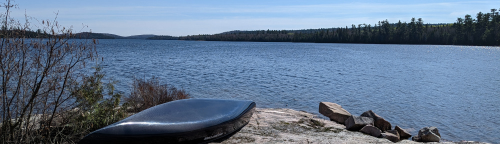
The less than 7km from the Ranger/Saymo portage to its northern most campsite took nearly three hours in this wind. The campsite here was quite nice, with a big rock landing, perfect for fishing and chilling out. It was also fairly well protected, so I decided to call it quits and stay for the evening.
This would turn out to be one of my earliest stops of the entire trip, with most other days pressing on much later before stopping. I hung my hammock, ate dinner, fished from shore and generally relaxed and enjoyed the evening.
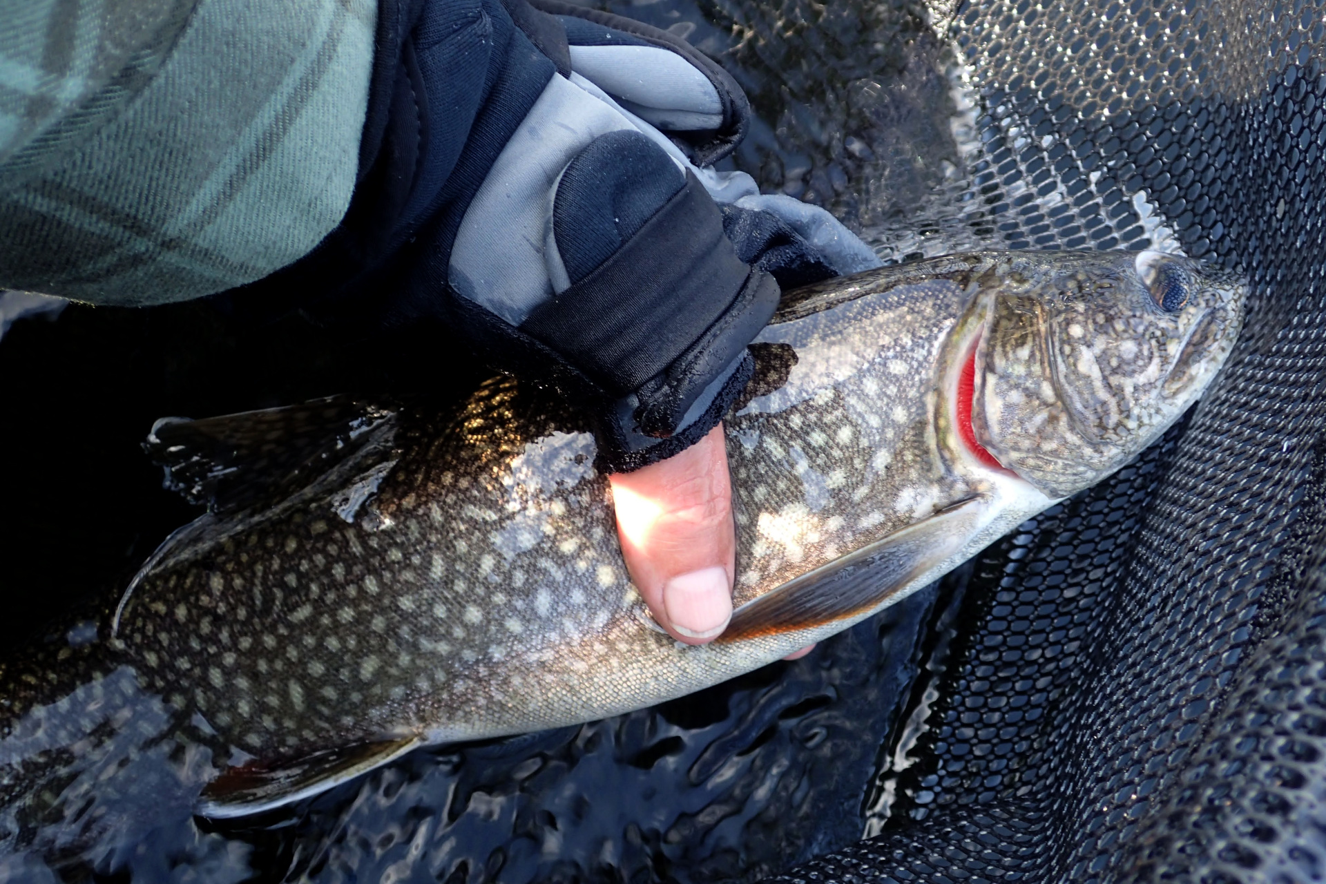
I also caught my first fish of the trip here – a decent lake trout. It was probably my largest lake trout of the trip as well – not big for lake trout standards, but respectable. Unfortunately, I fumbled with the camera as I was releasing the fish and ended up only getting a picture of part of its tail as it swam away. Oh well.

Day 2: Long Portage and Another Friendly Encounter
I woke to a nice morning and was in high spirits. I was a bit tired from yesterday’s headwind and generally not yet gaining my stride though, so I wasn’t moving particularly fast. I leisurely made breakfast, fished a bit and cleaned up camp, so it was around noon by the time I set off.
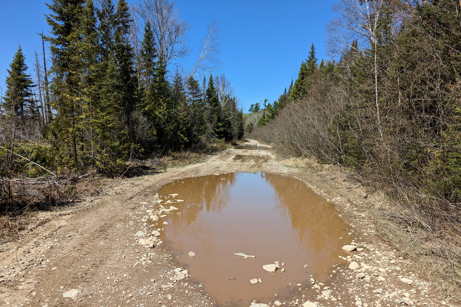
I had only about 1.5 km to paddle to the next portage, which was the largest of the trip. It was an almost 3 km portage, albeit on old forest roads (so, not very tough), connecting Saymo Lake to Island Lake.
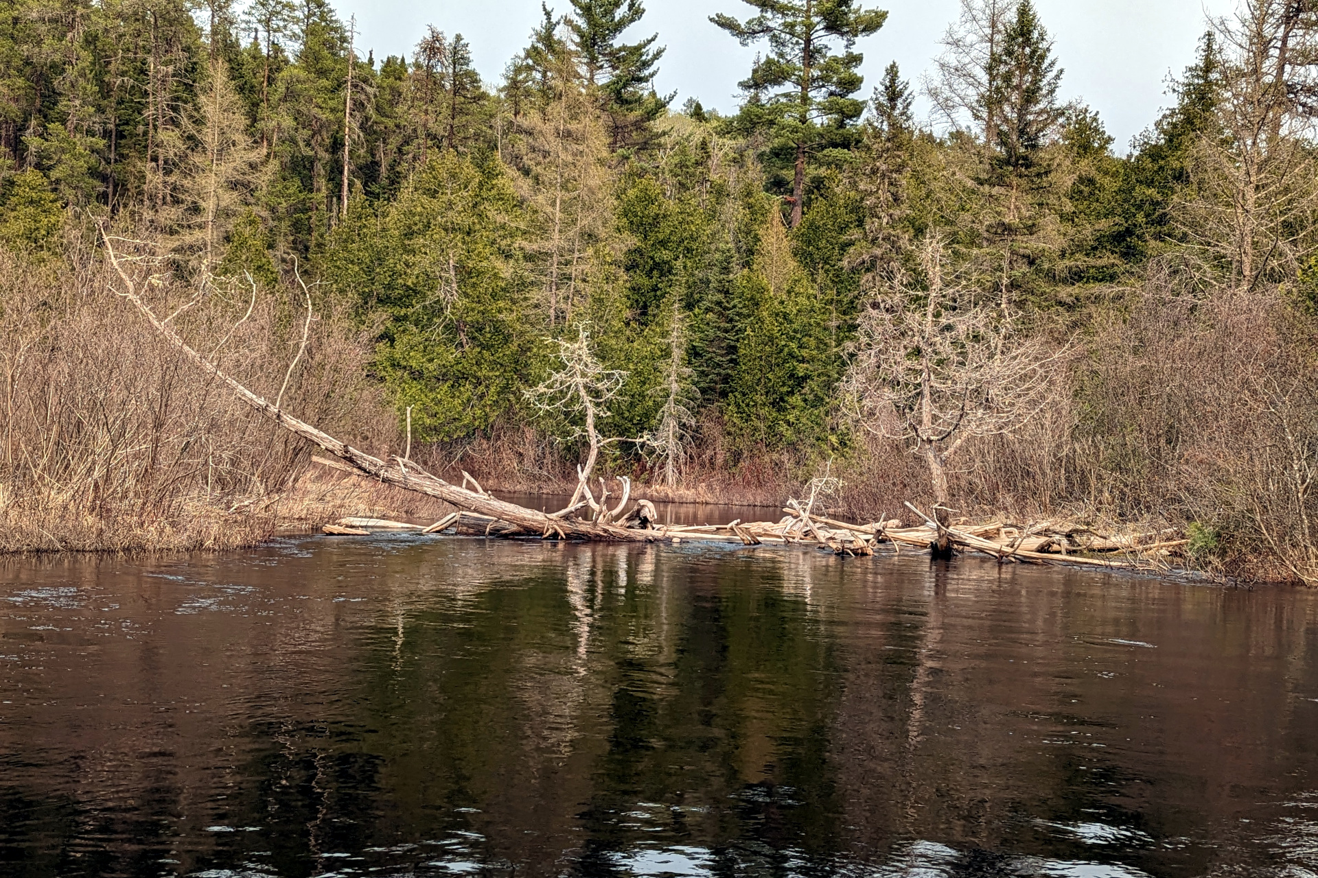
The section of Saymo here is calm, but rather slow going the closer you get to the portage. That’s thanks to a very shallow marshy area that’s riddled with tree stumps and submerged logs that you sometimes have to drag the canoe over. I can’t imagine trying to traverse this section in the summer or in low water conditions. There’s no way you could paddle it.
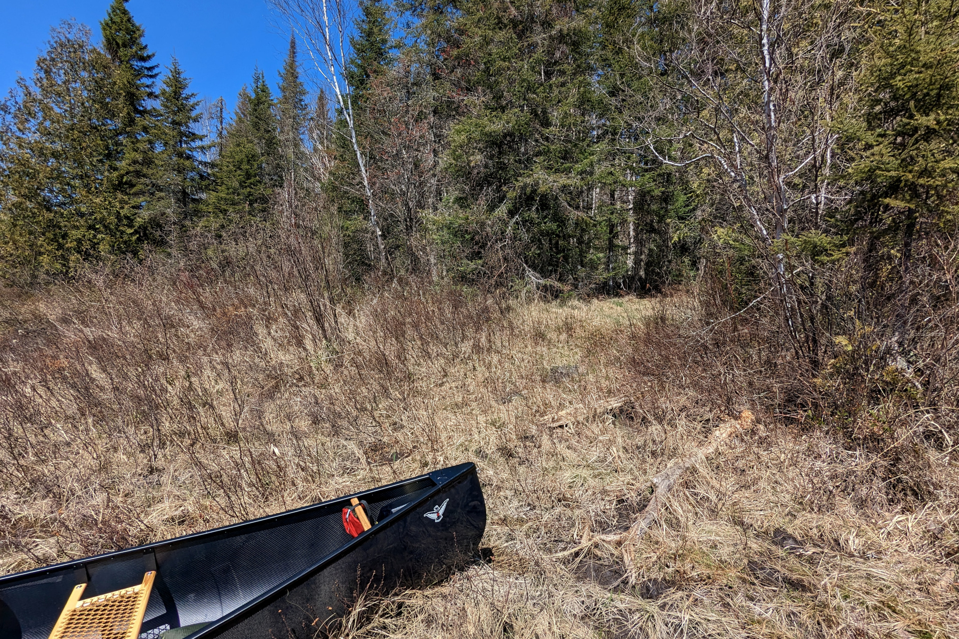
The start of the portage is a flat marshy area with a short path out to the old forest road. This path was absolutely littered with all manner of animal signs. Lots of Moose tracks, Bear tracks and a literal sh*t load of Bear scat – I mean it, you couldn’t even walk here. I’m pretty certain that some big Black Bear came out of hibernation, walked down to the river along this trail and basically dropped 10 lbs worth of weight along this trail.
As for the portage along the road, it was the same road (a continuation of it) that I attempted to drive up the day before. More washed out sections and even one section that you could (and I did) paddle a canoe through. It seems I forgot to take a photo of the section that I paddled through.
Interestingly, as I was carrying my first load down the portage, just before a right hand turn towards Island Lake, I saw a pickup truck parked along the side of the road. I was surprised to see it so far down the road in this condition. Seconds later, after turning right, I encountered the guy that owned it – another super nice fellow named Jeff. After chatting briefly, I continued down the road to the deep river-like section that is best paddled through. I dropped my packs here and started walking back to get my canoe and food barrel.
When I passed truck again, Jeff was still there packing up. He kindly offered to give me a lift back to my canoe. What luck I was having… help from strangers two days in a row! This was greatly appreciated, as it saved me about 2km of walking!
Thinking I’d just cheated perhaps the toughest portage of the trip, I was smiling. I should have known though, that the trip would only get (much) more difficult from here on in though. This was also the last person I saw for the rest of the trip.
I arrived at Island Lake around 4:15 and had a quick snack before setting off.
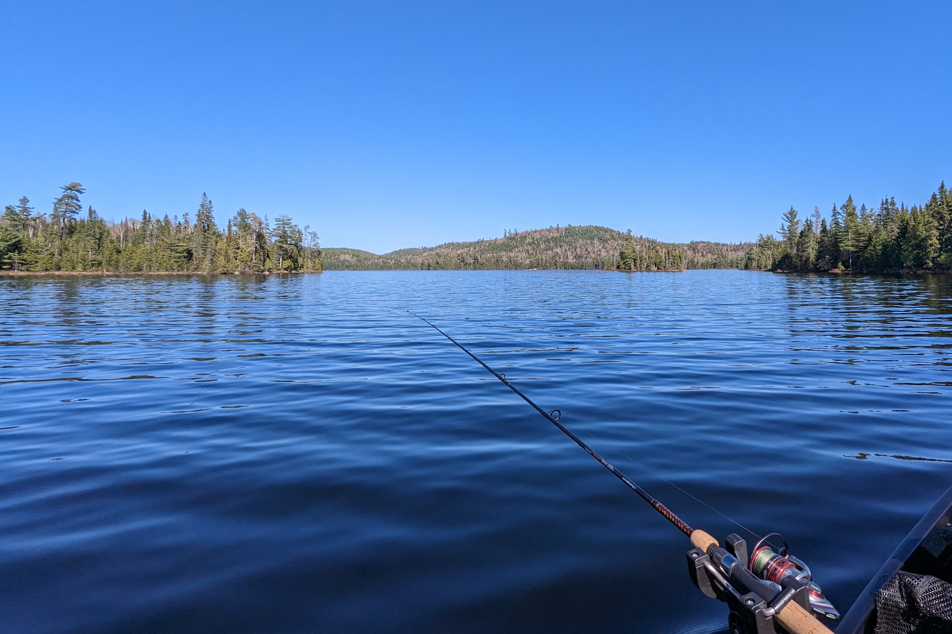
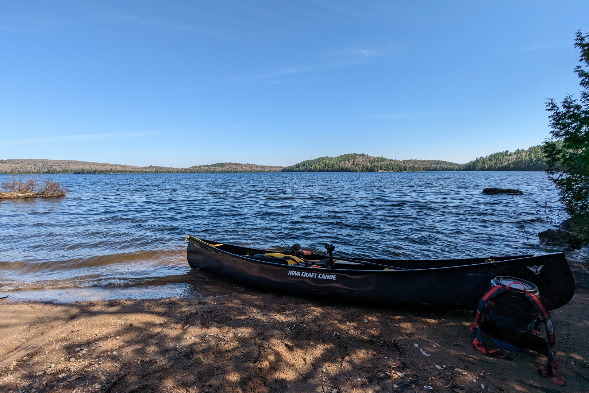
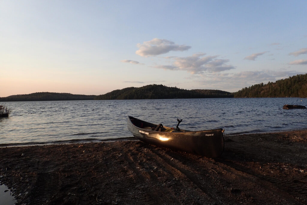
I suppose now’s a good time to mention, in case it’s not obvious from the photo above, that this trip was not a strictly fly fishing trip. I broke down and decided to also bring along a spinning rod for lake trolling. I’ve done my share of trolling in a canoe with a fly rod in the past and I’ve got to say – it’s simply not very enjoyable. The rod is too long, managing the line is cumbersome and getting your fly deep enough is not fun.
Given how many hours of a backcountry trip you spend paddling, I decided it only makes sense to double that time as fishing time, so my spinning rod became my trolling setup. This is the first back country trip I’ve ever brought something other than a fly rod on – and as much as I’ve been tricked into trying to be a “purist” in the past, I was extremely grateful to have given in. Trolling in this way greatly enhances the paddling and travelling experience.
That said, for the first half of the trip, I failed produce any fish while trolling. I mostly blame this on my learning curve of gear fishing for trout, but despite this, the trolling was still making my paddle more enjoyable.
It was about 5:15 when I reached the portage from Island Lake to Mystery Lake. Not satiated from my snack at the previous portage, I stopped for a proper meal here, before pressing on across Mystery Lake. The portage between the two lakes was about 420m and in decent shape.
It was 6:30 pm when I reached the end of Mystery Lake and the portage from Mystery to Gong Lake. This was a short and easy portage – less than 150m and fairly wide open. I assume that’s thanks to the active lodge on Gong Lake.
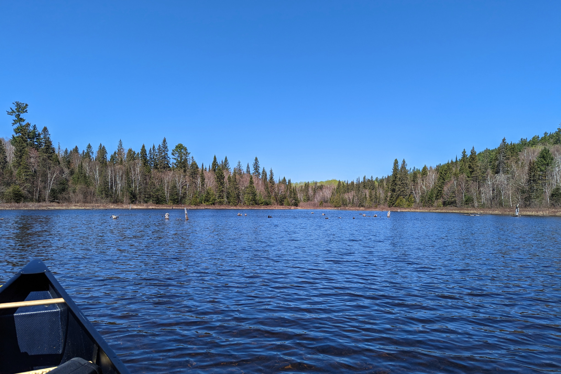
I was going to camp earlier on Island or Mystery Lake and do some fishing, but I couldn’t resist the urge to push a bit further and save myself some time on the following days. Ideally, I would have liked to have made it to a campsite on the West Aubinadong river, but that wasn’t going to happen with the late start. So, Gong Lake would become my home for the night.
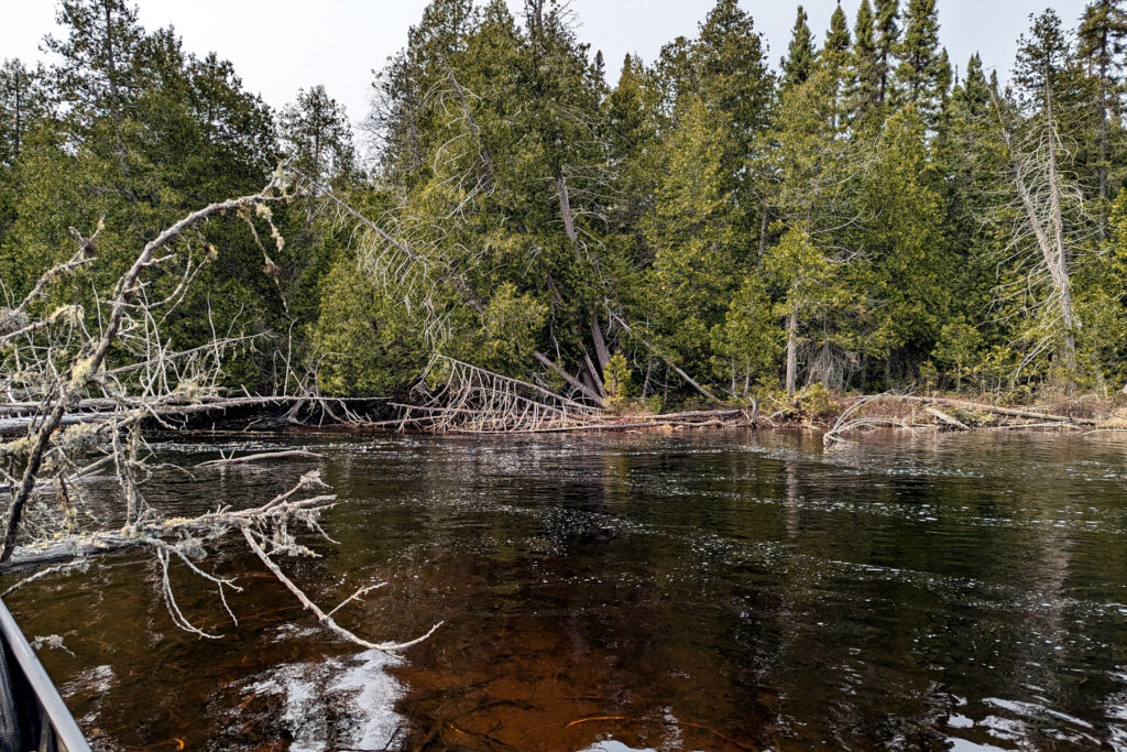
According to my maps, there should have been a campsite on Gong almost directly across from the portage. As I paddled across to the other shore, I could see a large rock landing as clear as day. This coincided with the campsite marked on the maps and I was sure it was it. However, when I paddled over, it was in complete disarray. Multiple large dead trees were lying across the campsite, there seemed to be no tent pad or opening to attempt to hang a hammock and there was no fire pit. I landed my canoe there to explore for a bit, but rest assured, this location is not suitable for camping. Perhaps someone with a chainsaw or a lot of time on their hands could restore it to a nice, useable site.
Anyway, I wasted some time here, then tried to decide where to stay for the night. The only other Gong Lake campsites marked on my map were on the other side of the island – which was quite a bit further away from the portage I’d be paddling to tomorrow.
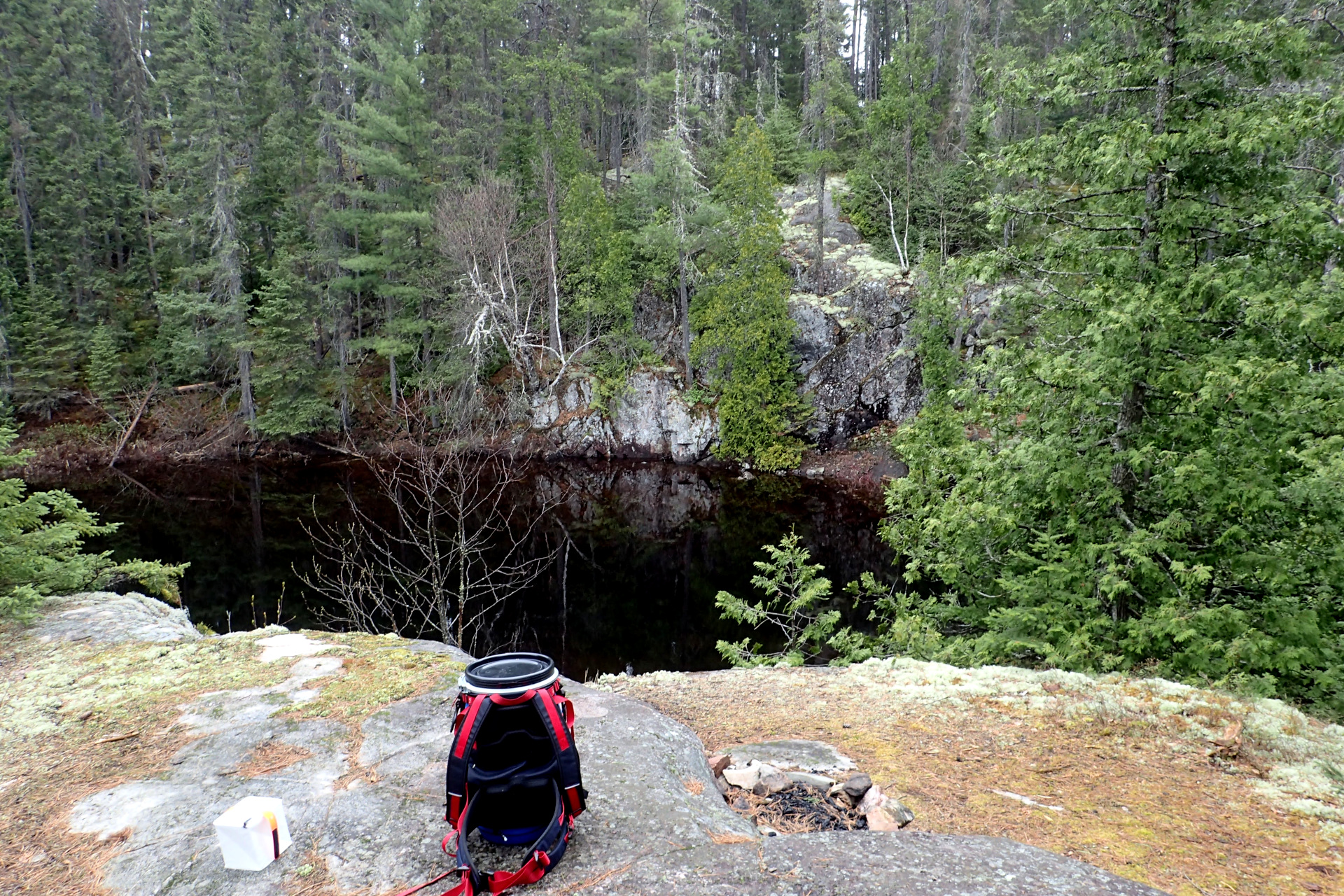
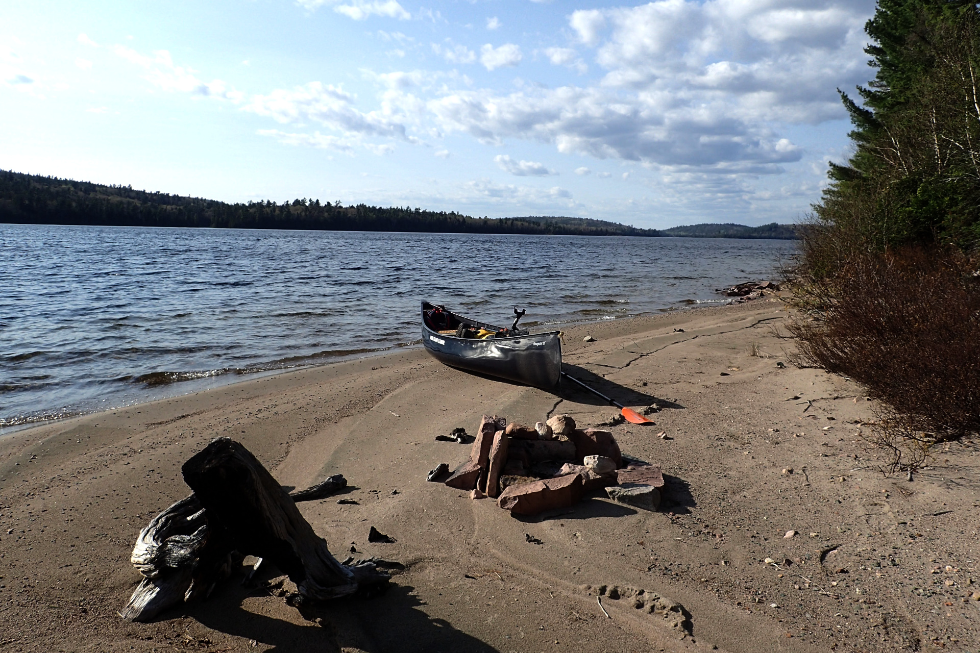
I decided to explore the shoreline I was currently on a bit more, wondering if perhaps there was indeed a useable campsite nearby that the maps were referring to (but incorrectly marked). Sure enough, southwest along the shoreline, on the point of the island, there was a nice little useable site, complete with a small rock landing, fire pit and spot to hang a hammock.
By the time I setup camp and was ready to start dinner, it was 8:50 pm – and it was after midnight by the time I went to bed.
Day 3: Upstream to the West Aubinadong River
Another common theme for this trip was late starts. Due to the late night, I slept until 8 am and got on the river shortly after 10 am.
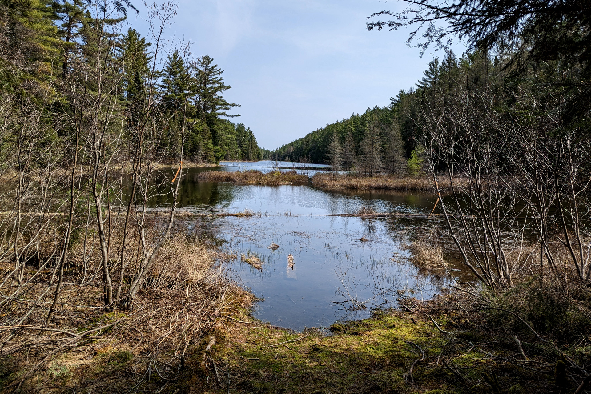
I had a 2.5km paddle northeast on Gong Lake to start the day, after which I would be facing a series of creeks, portages and travel upstream on the West Aubinadong River. I was finally able to take advantage of a tailwind as well, making the paddle from my campsite to the portage to Gong Creek effortless. I took advantage of this by slowly trolling and doing some fishing along the way.
The 400m portage from Gong Lake to Gong Creek was fairly uneventful, although the put-in at Gong Creek was somewhat marshy and muddy. It was just before noon when I started my paddle down the creek towards the longer 600+m portage.
The 600m Gong Creek portage was a bit more challenging than the previous portages. I spent a bit of time clearing some sections on it and it also had a fair amount of hills and rocky sections. It wasn’t difficult, just a step up from the prior portages.
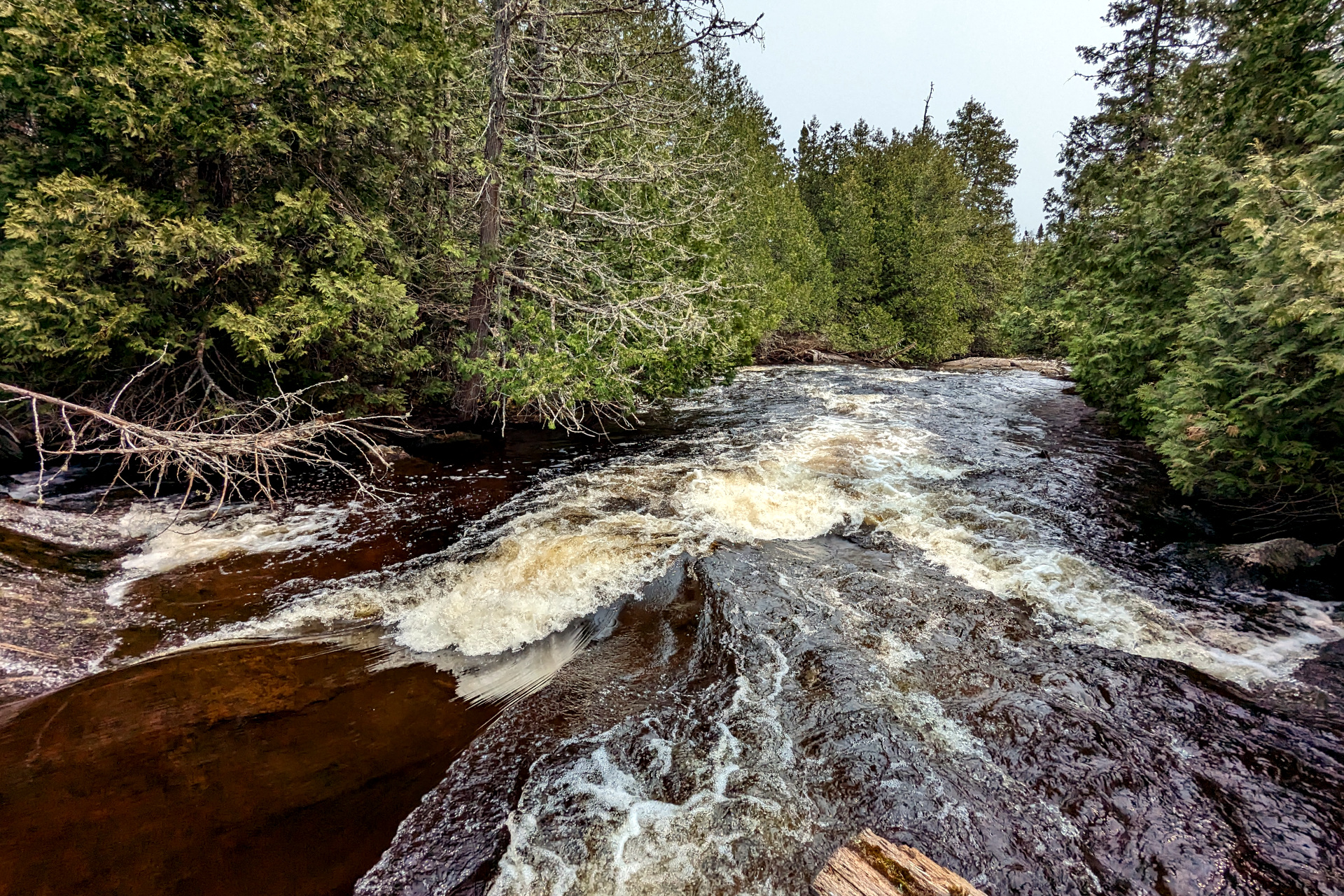
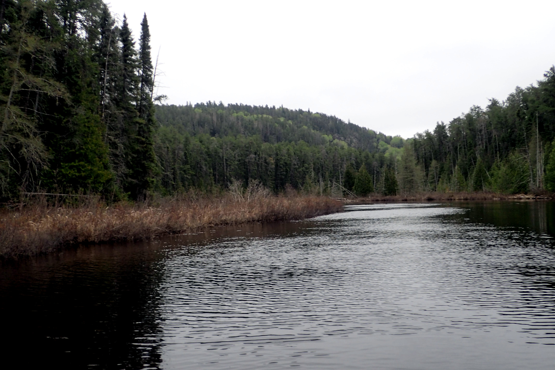
It was around 1:30 when I set off from here, paddling first through another section of Gong Creek before turning north on the West Aubinadong towards the Aubinadong / Nushatogaini confluence.
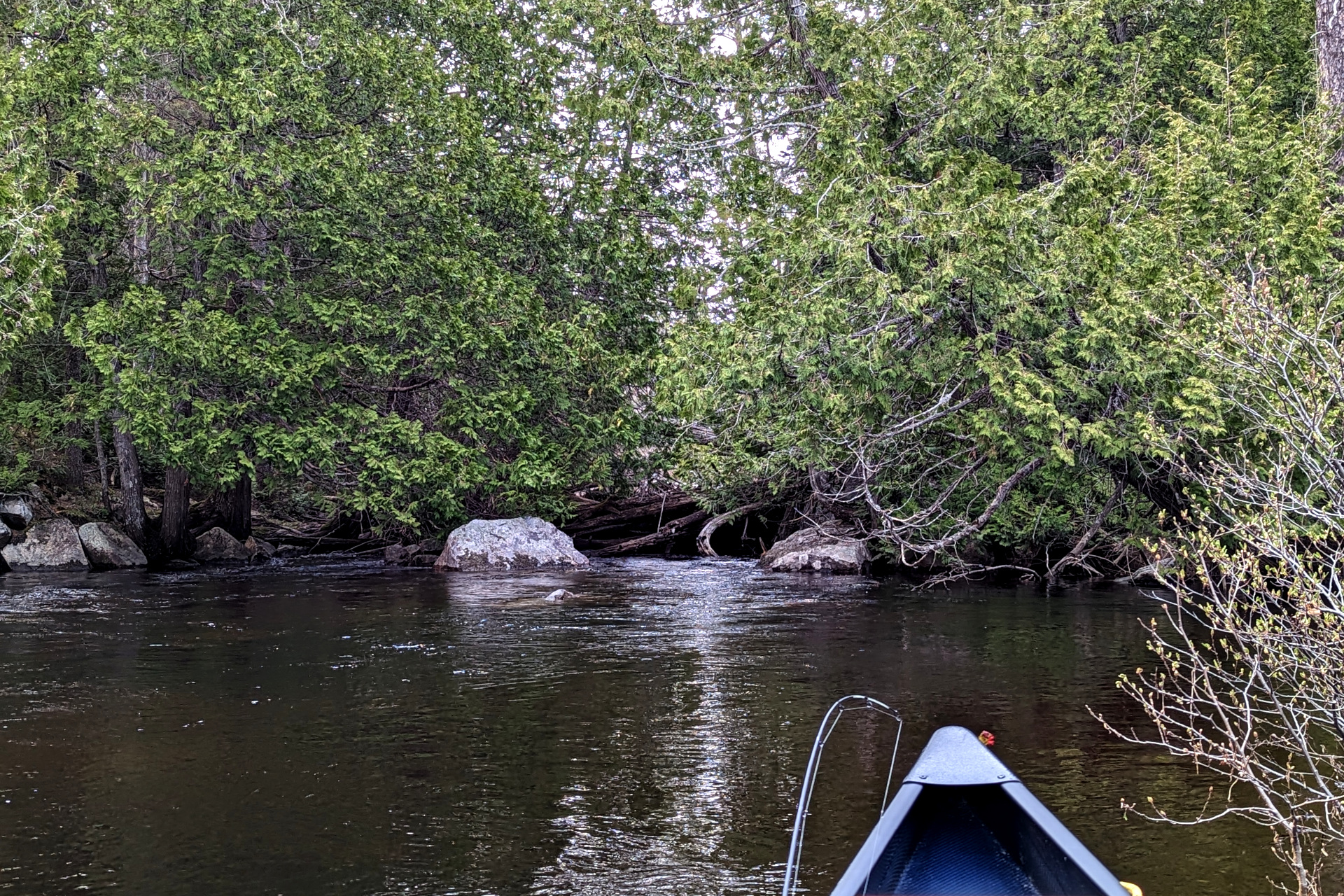
Travel from this point on would be upstream, against the current of the West Aubinadong. For much of the upstream travel, I would also contend with a headwind, making travel doubly as difficult. Thankfully, I accounted for this paddling slowness in my planning. What I didn’t fully account for however, was the difficulty in both finding and completing many of the portages.
It was 2:30 when I arrived at the first of the river portages. It was a short 120m, which was straightforward aside from needing a bit of clearing – something that would be a requirement for nearly every portage from here on in. I assume I was the first person to travel up this far this year. Although someone could have theoretically bushwhacked a canoe and gear through many of the portages without clearing them, it wouldn’t have been very pleasant. Hopefully my efforts on the portages will make the next person’s travels that much more enjoyable.
After finishing the 120m portage, I continued upstream towards the first campsite on the West Aubinadong. In my plans, I had considered staying at this site, depending on the time. One of the challenges on this river is the lack of campsites. If you pass up a site, it might be quite some time before reaching another one. And since I’m hammock camping, a larger clearing is generally needed, so it’s more difficult to find or create a clearing in any random spot along the river.
It was 4:00 pm, so I figured I’d have plenty of light left to make it further upriver to camp. I knew there were some campsites in the narrow gorge-like “chutes”, about halfway up the river towards Torrance/Megisan, so figured I should have no problem making it there in decent time. After all, it was the north end of the river and Torrance / Megisan Lakes that I was really aiming to reach.
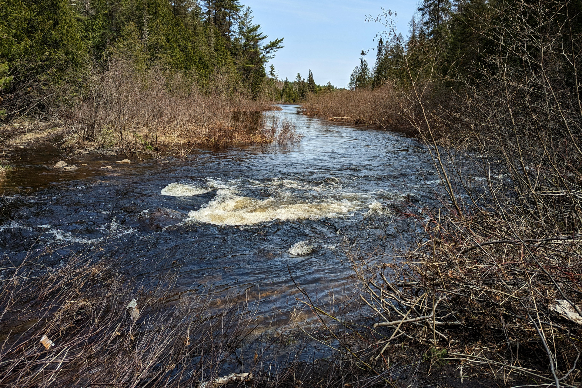
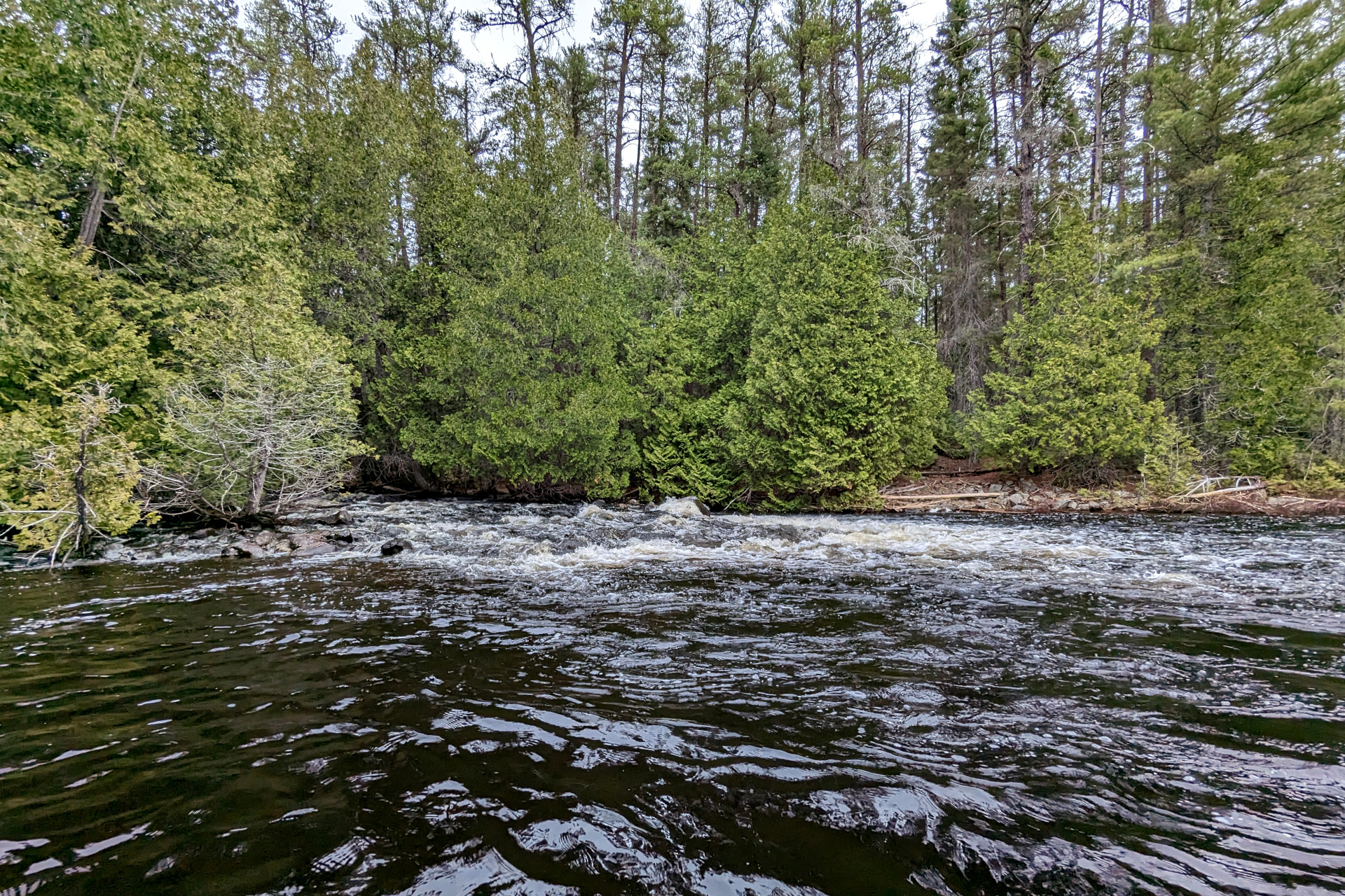
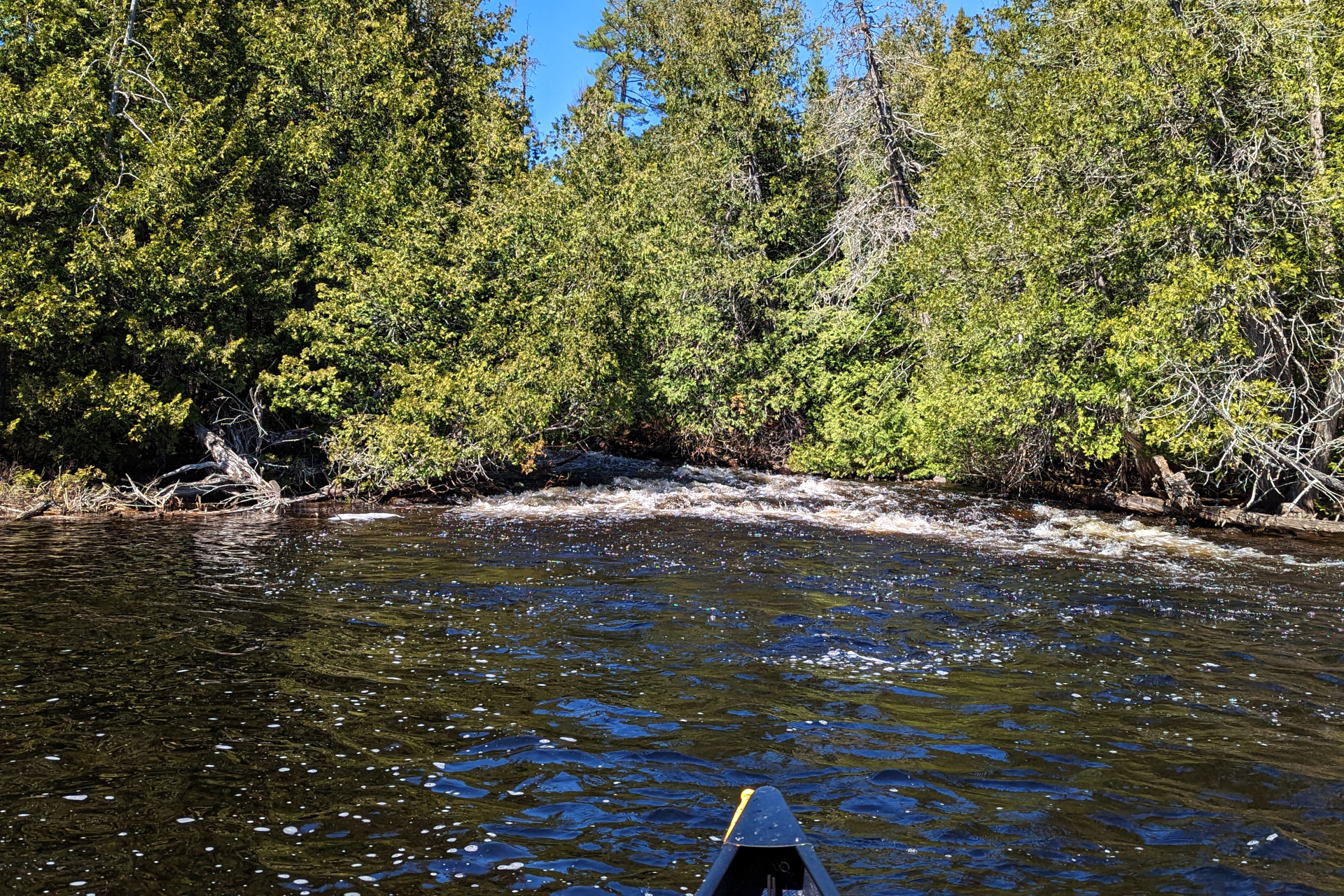
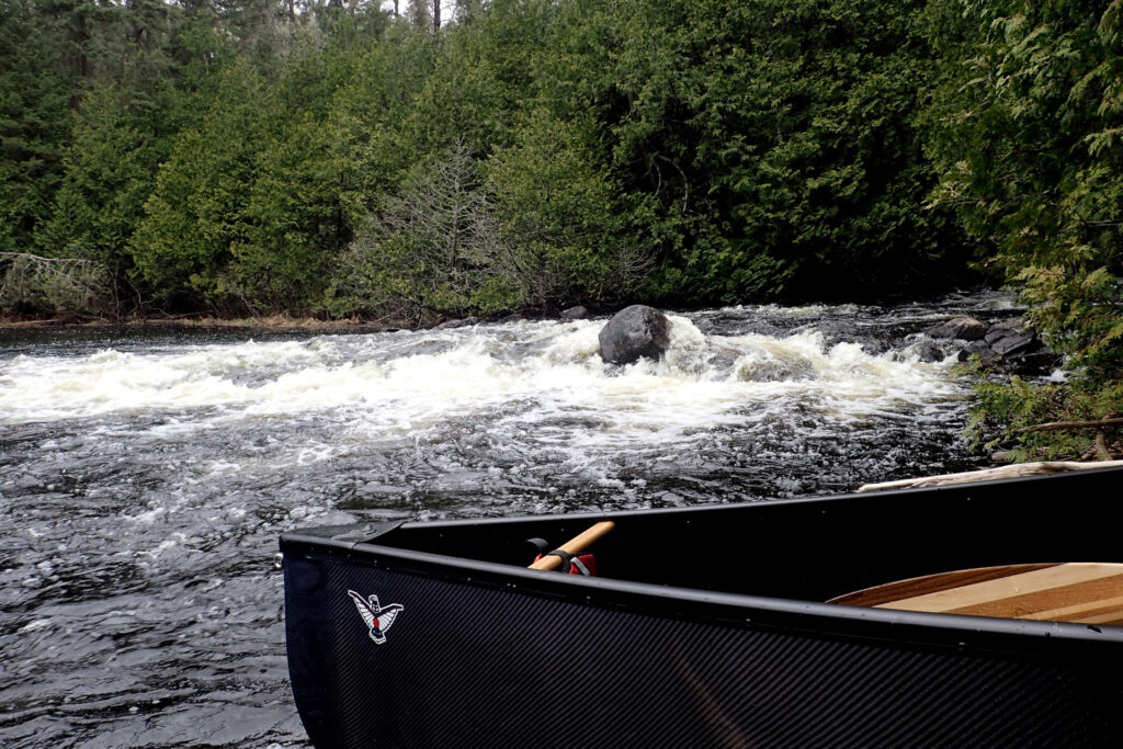
Suffice it to say, this wasn’t the wisest of decisions, as it led to me pushing myself quite hard for the rest of the day and almost having to continue the upstream travel in the dark. To sum it up, several portages needed a great deal more clearing, as well as several log jams that I either needed to pull the canoe over (without falling in), find a way to drag the canoe over the shore/bank, or carve out a small portage around them.
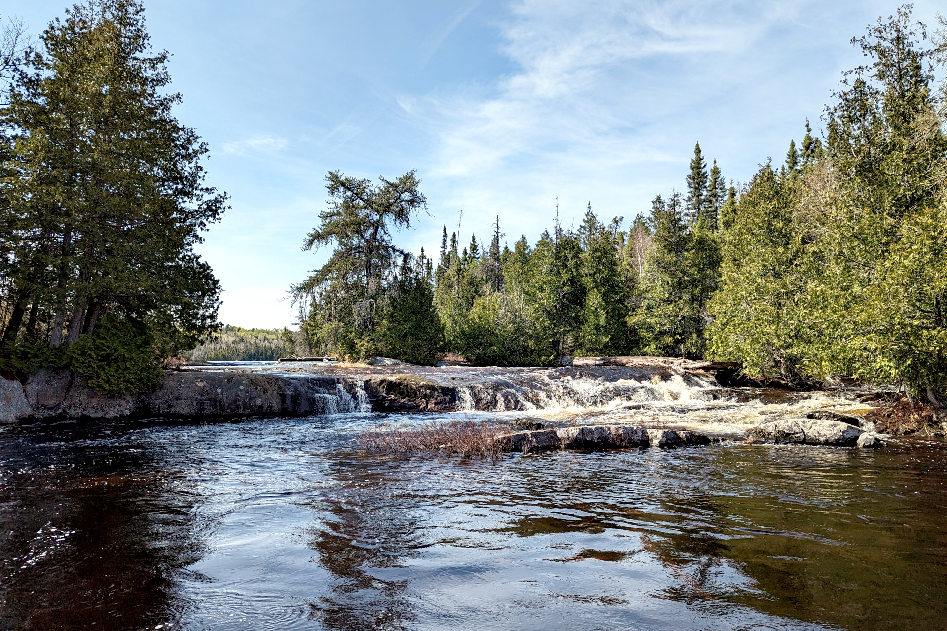
It was around 8:00 pm when I arrived at what was supposed to be a short 30m portage. After this portage there would be one more 300m portage, after which I would hopefully arrive at one of two campsites on the “chutes” section of the river.
Unfortunately, this tiny 30m portage turned into a 40 minute ordeal. I simply could not find the portage, nor did it seem like this was a mere 30m portage – at least not going upstream. There was a fairly quick current/rapid here, one that I was unable to paddle up – so if there was a take-out further upstream, I would either have to wade/line through the middle of the river to reach it, or not reach it at all. The temperature was dropping and I couldn’t see the bottom of the river well enough to gauge its depth. In other words, I wasn’t keen to jump out of my canoe this close to dark and in these temps, without knowing what the depth was and what the river bed looked like.
At one point I did find what seemed like a portage on river right – and I even unloaded my gear and started to carry it, before realizing it wasn’t a portage at all. Eventually I crossed the river and backtracked a bit, to find what looked like the real portage trail. I carried the portage, which again needed a bit of clearing. It was definitely a lot longer than 30m though, which was weird given the other maps and trip reports I had studied. I would find out where I went wrong in a few days on my way back down the river, but for now I was happy to be through it!
At 8:40 pm, light was fading fast in the thick forest and canopy cover of the narrow river here – and I was fairly certain I wouldn’t be able to make it to the campsites at the chutes that I wanted to. Travelling this wild river and trying to find portages in the dark was out of the question.
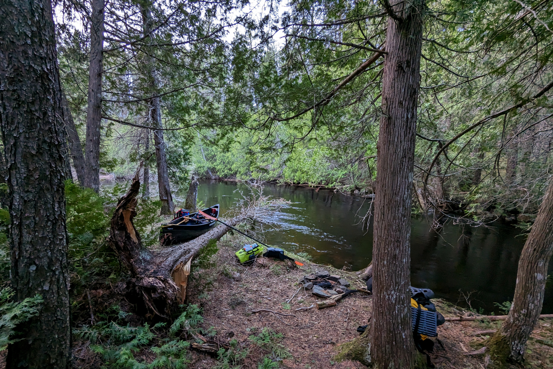
It’s almost like the river was looking out for me tonight though… because to my pleasant surprise, as I gathered my thoughts at the end of the portage, I noticed a small campfire and a small clearing just large enough to setup camp. This site wasn’t on my maps, but I was relieved to have found it!
There were two minor issues with this site.
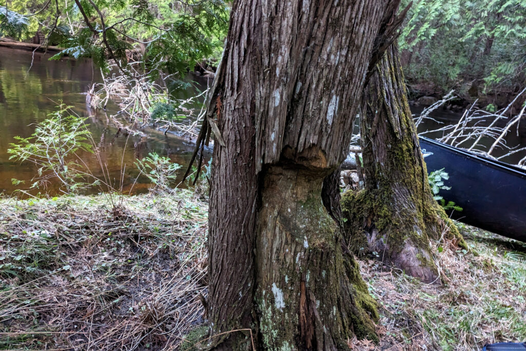
The first issue was that the only suitable hammock hang was using a tree that a beaver had half chewed through. As sketchy as it looked, it seemed like quite the old “chewing”, as the bark was growing back around the damage and the tree still seemed very sturdy, despite leaning somewhat in the direction of the beaver damage. Not ideal, but I deemed it safe.
The second issue was the loud rapids at the campsite. I don’t love sleeping beside such rapids, as it makes it difficult to hear other… things. Speaking of such things, what a weird night sleeping this ended up being!
First I was awoken by what sounded like my dad doing a cannonball into the river next to my campsite. A minute later, the same loud ka-ploosh. This continued for roughly half an hour, every minute or so. I never did get to see what it was, but given my experience with beavers on the Credit River back home, I assume that’s what it was – a beaver slapping the water with its tail. If you didn’t know they did this, you’d certainly be very creeped out!
Next, much later in the night, I awoke half in a trance to a loud breathing sound outside my hammock. I was totally frozen, too chicken to peek or move. As if whatever animal stood outside my hammock couldn’t see the large blue pinata hanging between the trees. Seconds later, I heard its footsteps walking and then I could hear it slurping water from the river beside my campsite. I was still too afraid to rustle around in my hammock and peek, but my assumption this time, based on the sounds and drinking, was that it was a moose. That’s definitely what I’m going with – because I refuse to accept that there was a bear outside my hammock in the middle of the night.
Day 4: Hobbling my way to Torrance Lake
After the chaotic night, without much good sleep, I woke around 7:45 am and was on the water shortly after 10:00 again.
Yesterday had been a tough day and in retrospect, I shouldn’t have pushed so far into the evening on this river. Thankfully I was lucky enough to find the campsite at the end of the portage – although all the wildlife action that evening is a good reason why camping on a portage isn’t the wisest idea. Animals like portages even more than humans do!
At any rate, knowing what to expect with the portages now (i.e. clearing work and difficulty locating them), I set out with more reasonable expectations.
I made fairly quick work of the first 300m portage of the day, then headed for the chutes, which was my original target destination from Day 3. For some reason, because there were two campsites marked on the left/west side of the river, I assumed there had to be a portage there. So, I searched, and searched, and searched for a portage on the left side of the river. I got out of the canoe a couple times at what looked like possible portage entry points, only to find a mess of downed trees and choked up forest. If there ever was a portage on the west side of the river, it’s either been completely lost to the forest, or I’m blind.
I eventually gave up on river left and found the portage on the right side of the river just below the rapids. The portage on this side was quite rugged and also was very much in need of some clearing. I ended up “triple” walking this portage, because the trail wasn’t super obvious in many spots and there was just too much clearing needed to do so with 100 lbs of gear on my back.
I know at least a couple groups did this route last year, so I’m quite surprised at the condition of many of the portages – especially this one. Either there really was/is another portage, or it was a particularly harsh winter here.
It was after 2:00 by the time I reached the end of the portage and continued upstream. From the put-in at the end of the portage, I could see a large rock across the river that turned out to be the upper/northern chutes campsite. There was clearly no way I would have made it here the night before!
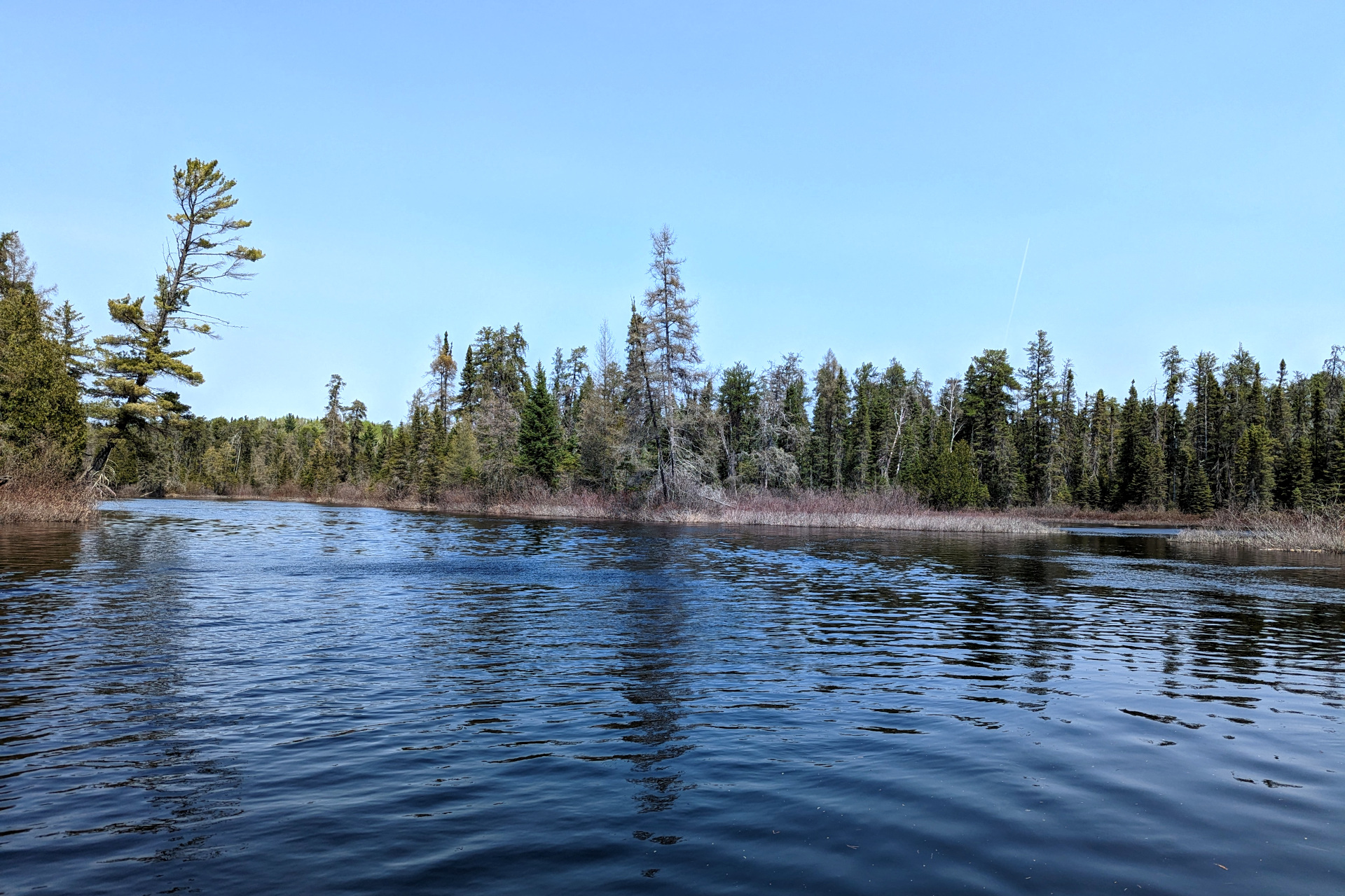
Paddling upstream, it wasn’t long until I reached a widening of the river that almost resembled a small lake. There’s an old Trapper’s cabin located on this part of the river that I would have liked to stop and see, but it was a bit out of the way and I was eager to continue upstream. I figured I could always do some sight seeing on my way back instead, if I had the time and energy.
My target for the day was to reach Torrance Lake and according to the map, there were at most 3-4 small to medium sized portages left. Of course, the map doesn’t tell the whole story – and as usual, there were also a few extra log jams to also contend with.
Shortly after 5:00, I reached a logjam that was too difficult to lift over. Instead, I had to clear and trudge my way through a small, muddy, rocky path on the left side of the river. In doing so, while stepping into the black murky water trying to find my footing, I stepped on the side of a slippery rock, felt my ankle fold over and heard a “crunch”. That was me hopefully not spraining my ankle… but the sound and feeling of the “crunch” was not very reassuring.
I’ve had a countless number of ankle rolls in my life and they almost never materialize to much – at least not since my high school basketball days. At first, I issued a sigh of relief as it seemed I could still stand and walk fine on it. However, a couple steps later, I felt a severe shooting pain in my foot. I panicked for a second, then tried moving my foot in a few different directions again, hoping that pain was either imagined, or somehow not real. However, I soon realized that my ankle was indeed weak in certain positions and caused serious pain if I stepped with anything but a fixed, straight foot position.
After blurting out a few obscenities, then deciding whether I should panic or pull myself together, I managed to do the latter and carefully carried the rest of my gear to the other side of the log jam. I weighed my options, understanding that I was stuck in a section of river with no campsites and at least one or more rugged portages in either direction, to get to a campsite.
My choice was either turn around and head back to the chutes campsite, or continue north and try to make it Torrance Lake. One (Chutes) would get me closer to home should I need to cut my trip short, but the other (Torrance) would put me on an open lake where any sort of evacuation would be much easier – not to mention, it was my intended destination in the first place. I chose to continue on to Torrance Lake, which was two portages away – one roughly 225m and one 60m.
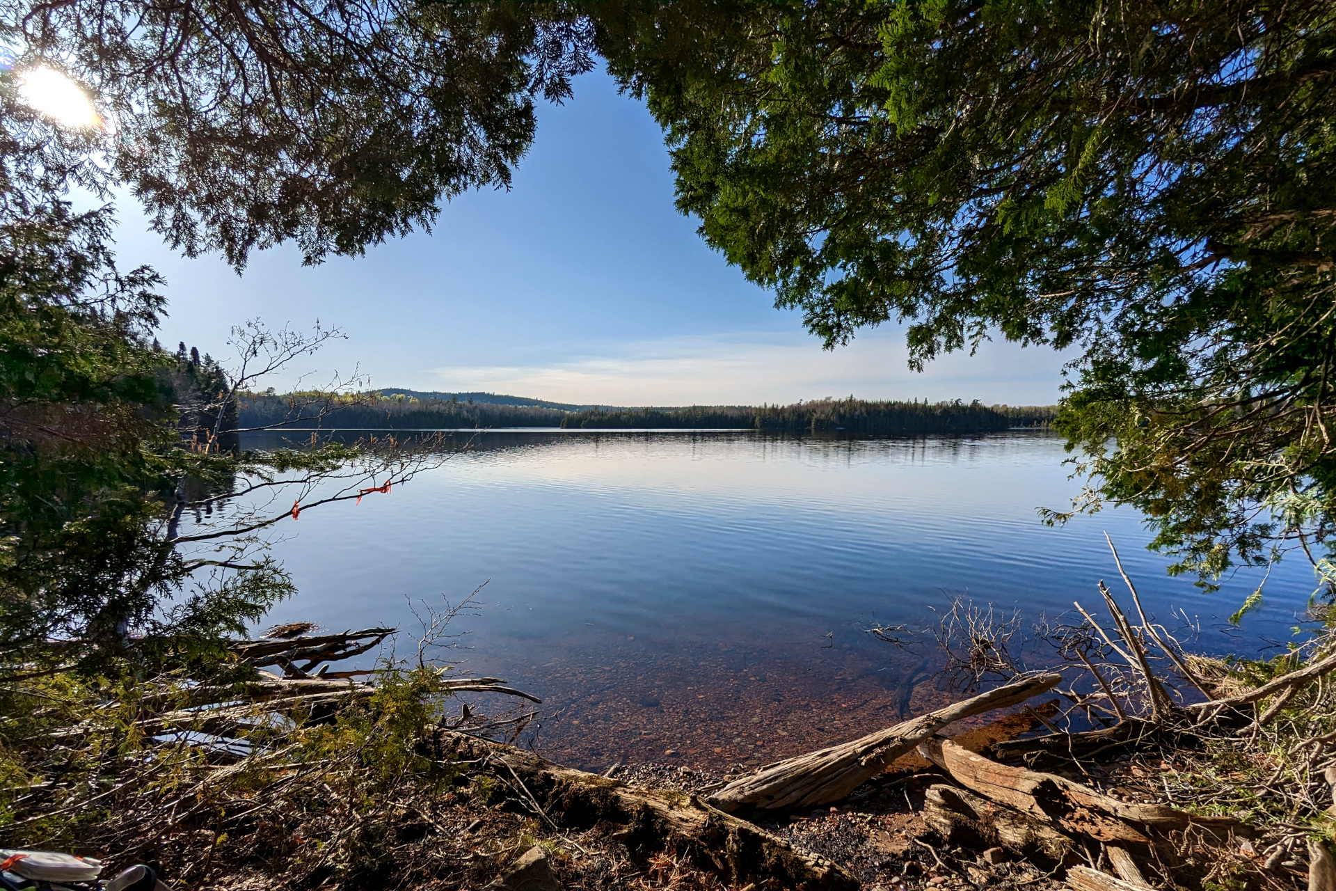
As a result of my ankle injury, I passed up any and all fishing opportunities on the river – thinking only of getting to my target campsite so I could rest and unwind. By constantly watching my footing on the remaining portages, I was able to complete them and arrive at Torrance Lake by 7:15 pm.
By this time, my ankle was feeling fairly sore and weak, but I was relieved to be in a wide open lake with hopefully a roomy campsite to rest and relax at. I’d already decided that I would take some Advil, get some rest and stay put tomorrow (rest day) before re-evaluating my ankle and deciding what to do. I was ever so slightly hopeful that some Advil and a night’s rest would offer some improvement – and was prepared to try a duct tape ankle wrap if needed.
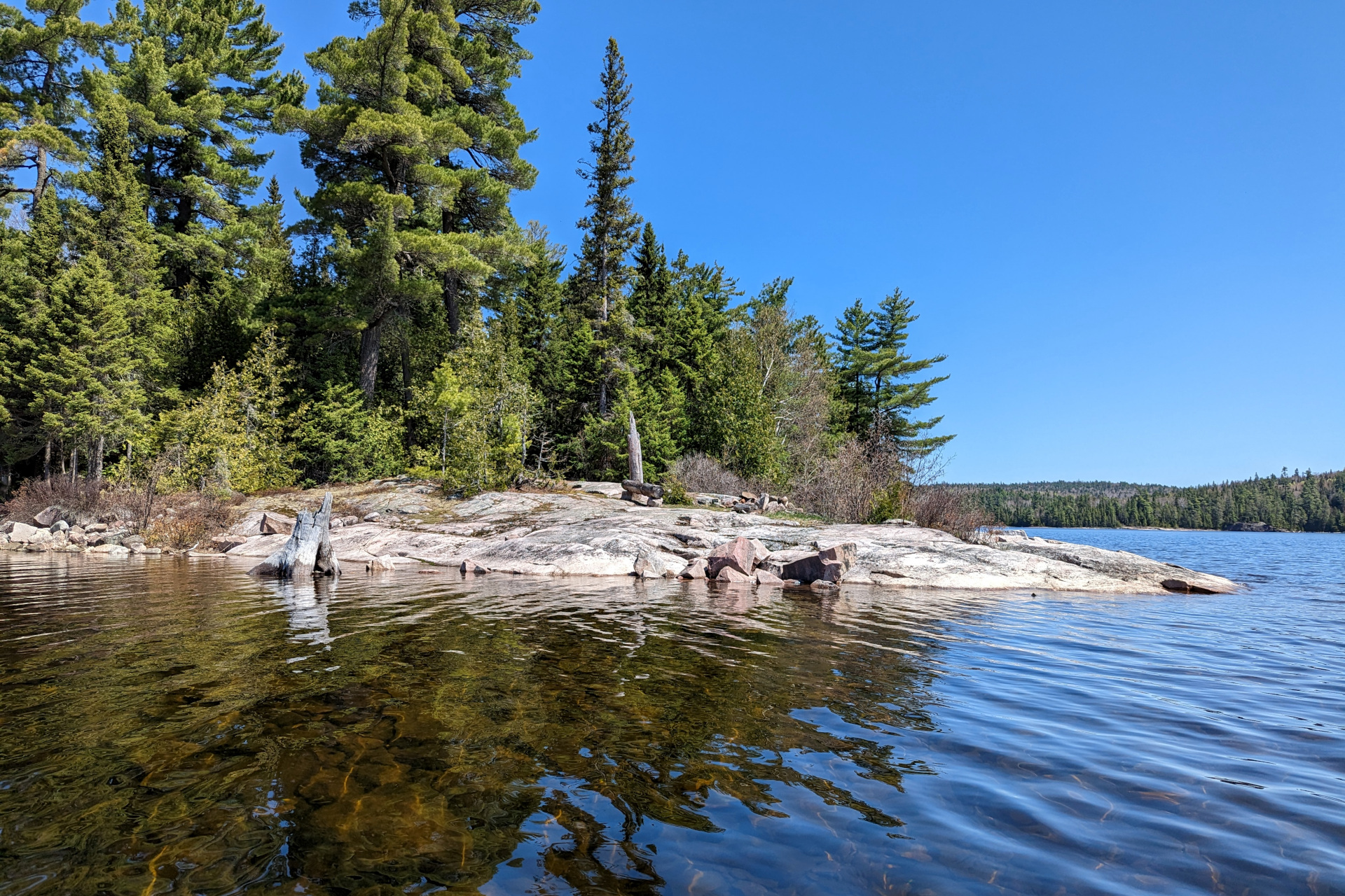
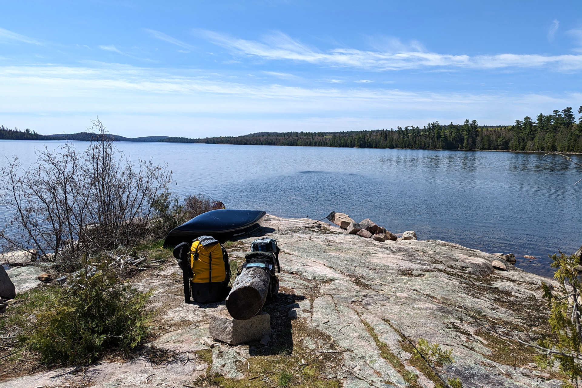
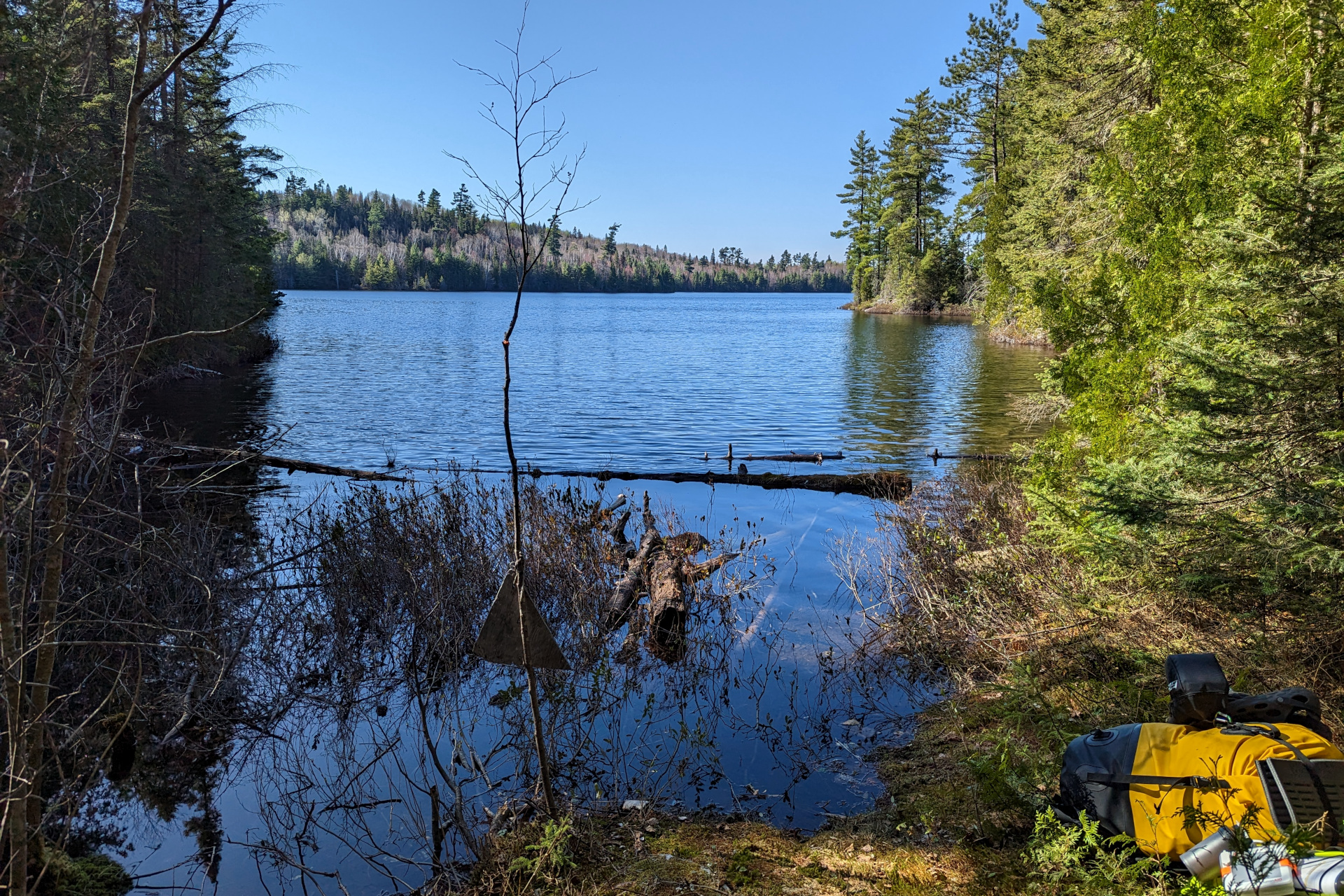
There were two campsites marked on my map. The first one looked fairly decent and I was tempted to just stop there. But given I was planning to stay put for two days, I couldn’t resist paddling the extra 800m to check out the northern most site.


The more northern campsite was quite nice indeed, at least from afar, with its large rock ledges and spacious nature. However, the rocky access was definitely more difficult with my ankle and it also somehow felt slightly less “homey” – and more used. So, back to the first campsite I went, where I unloaded my gear, changed into dry clothes and got dinner started.
My InReach weather forecast was showing a low of -3 degrees overnight and even colder (-6) the next night! I don’t know how cold it actually got, but my water was frozen when I woke up, so it definitely went below zero.
Day 5: Rest, Fishing and Optimism
My spirits were quite low last night after rolling my ankle. I had thoughts of having to hit the SOS button on my InReach, thinking of the grueling portages that lay between me and my truck and whether I’d possibly be able to haul my 150+lb of gear all the way back there.
But, it’s easy to get down out in the wilderness, when you’re by yourself and things get hard or go a bit south. When I awoke in the morning, after getting a good night’s sleep and resting both my body and mind, I felt much better. Knock on wood, my ankle had no visible swelling that I could see. I was still babying it a bit, cringing at the thought of feeling that awful shooting pain I’d been feeling the day before – but for the time being, it was feeling better.
I was in absolutely no rush today and my priority was simply to rest and nurse my ankle back to functionality.
After a late breakfast and coffee, I tried my luck at a bit of fishing from camp. Somehow, I managed to make it 5 days into my trip with barely any fishing (outside of some trolling when winds allowed it) – on a trout fishing trip! That sums up the difficulty of reaching this point.
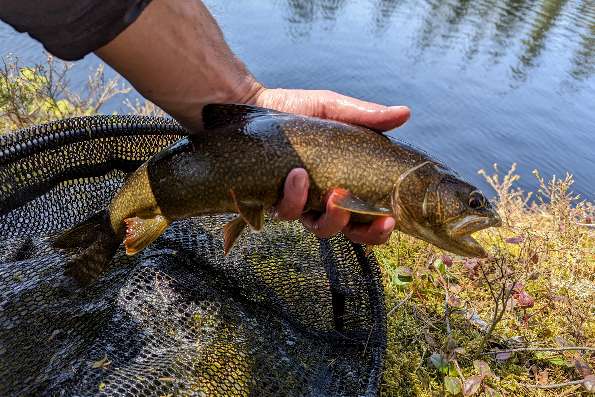
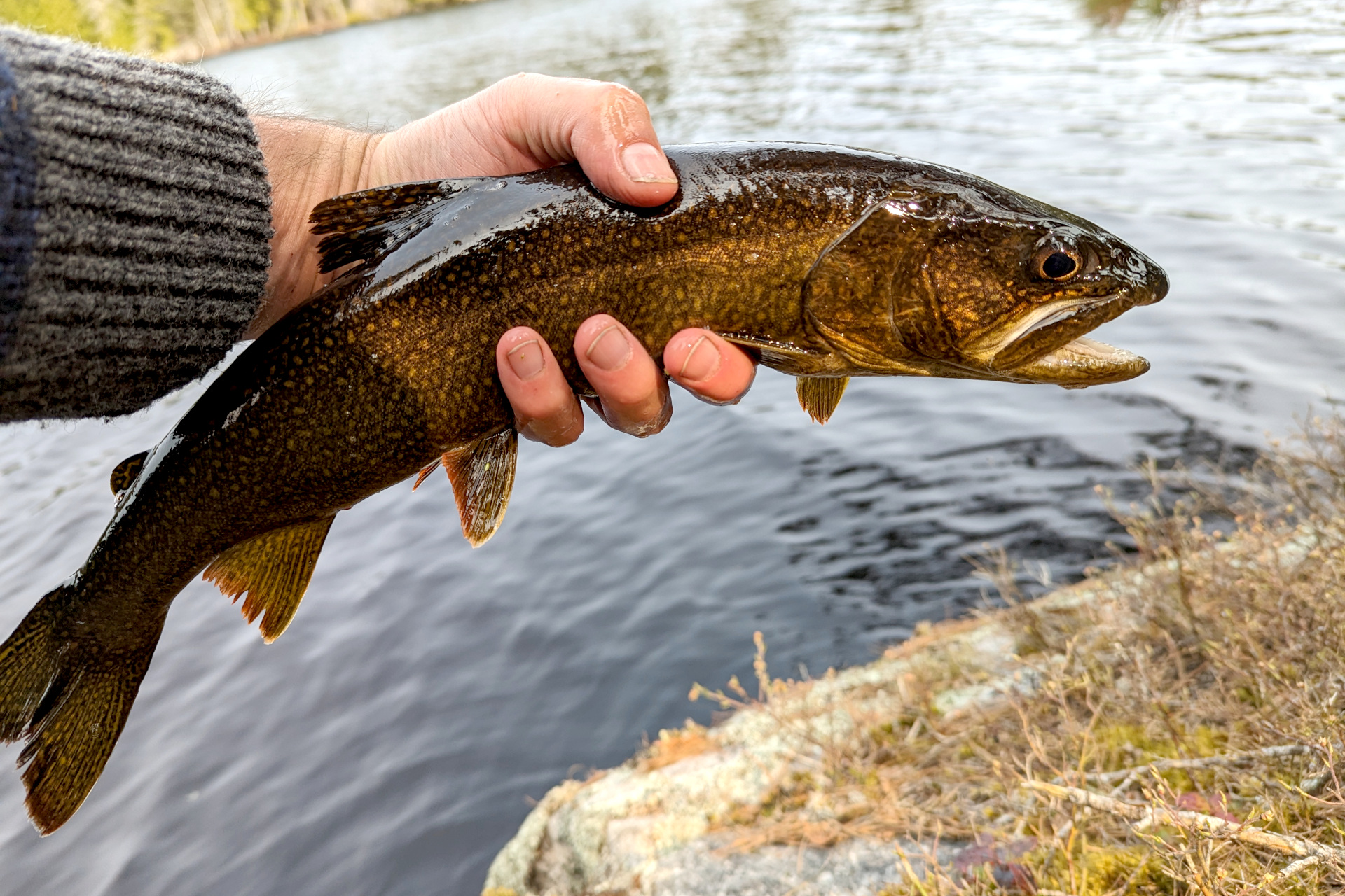
That said, on my very first cast, I had a Lake Trout follow. Second cast, it once again darted out from the rocky shoreline and this time it hit. That was quick… things were indeed looking up!
The high was around 12 degrees today, but there wasn’t much wind and it was a nice sunny day. My ankle was feeling well enough that by 4:00 pm, I decided to venture out for a bit looking for some brookies. I took only minimal gear and didn’t push myself too hard.
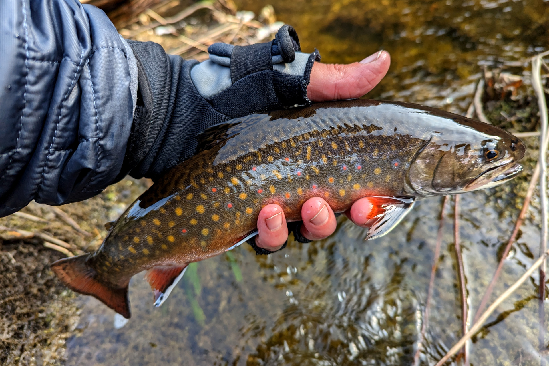
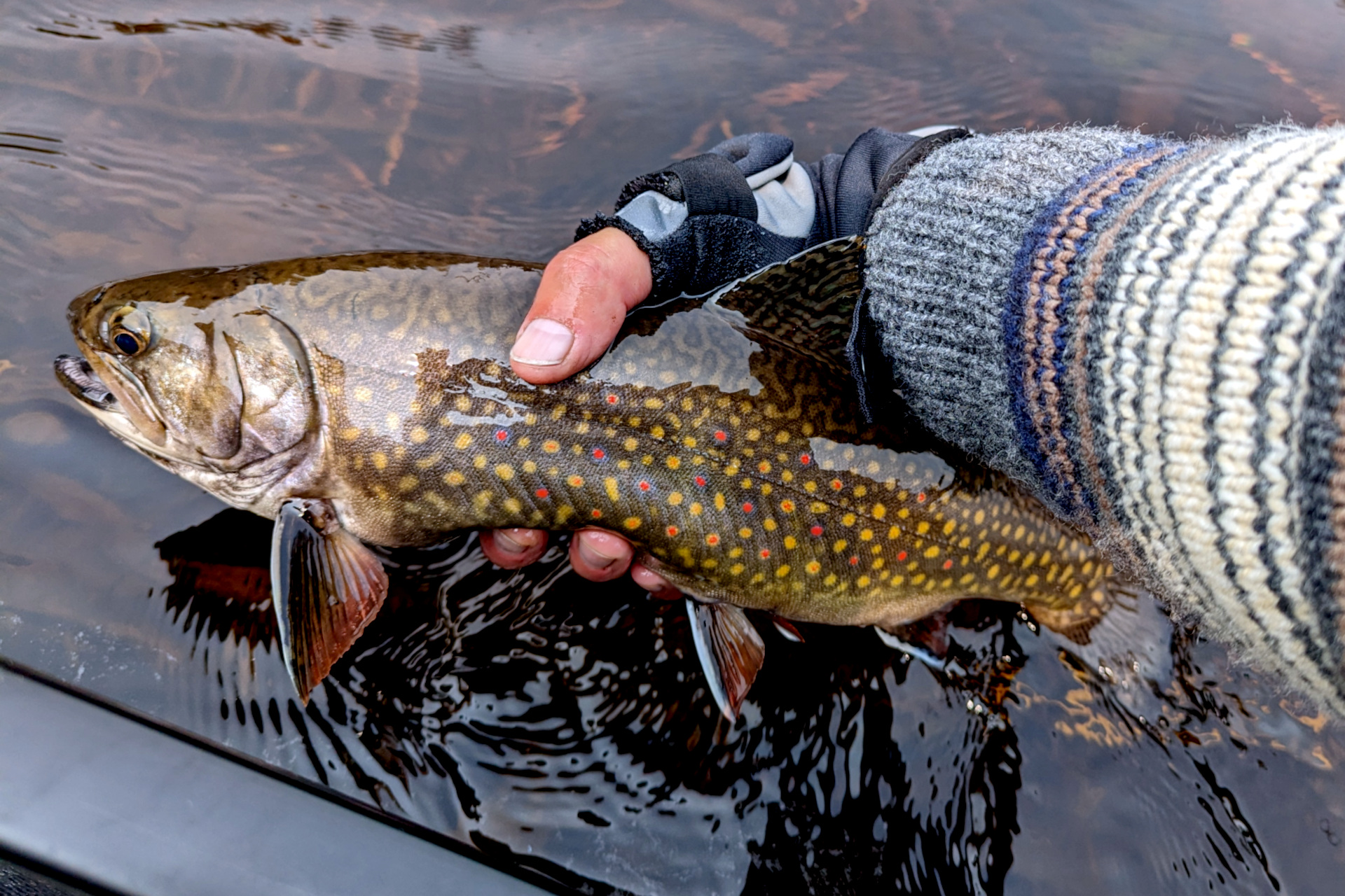
My luck continued to improve, as I finally did manage to get into a few brookies! I actually lost several – including one larger one – before finally netting a couple. The brookies here were some of the most energetic, hyper brookies I’d ever caught. They were dancing all over the water, rolling and squirming their way off the hook in every way possible. Of course, my hooks were barbless as well (always are).
Despite having my most successful fishing day of the trip so far, it was a delightfully uneventful and relaxing day – exactly what I needed.
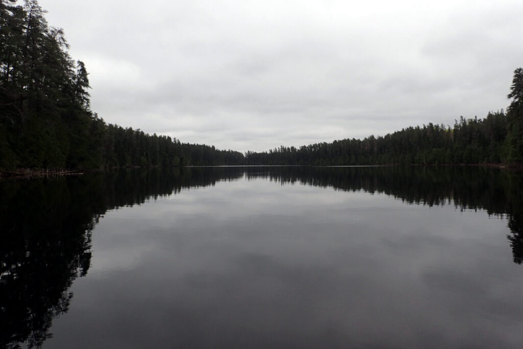
The paddle back to camp in the evening was serene, with little to no winds and Torrance Lake almost a sheet of glass.
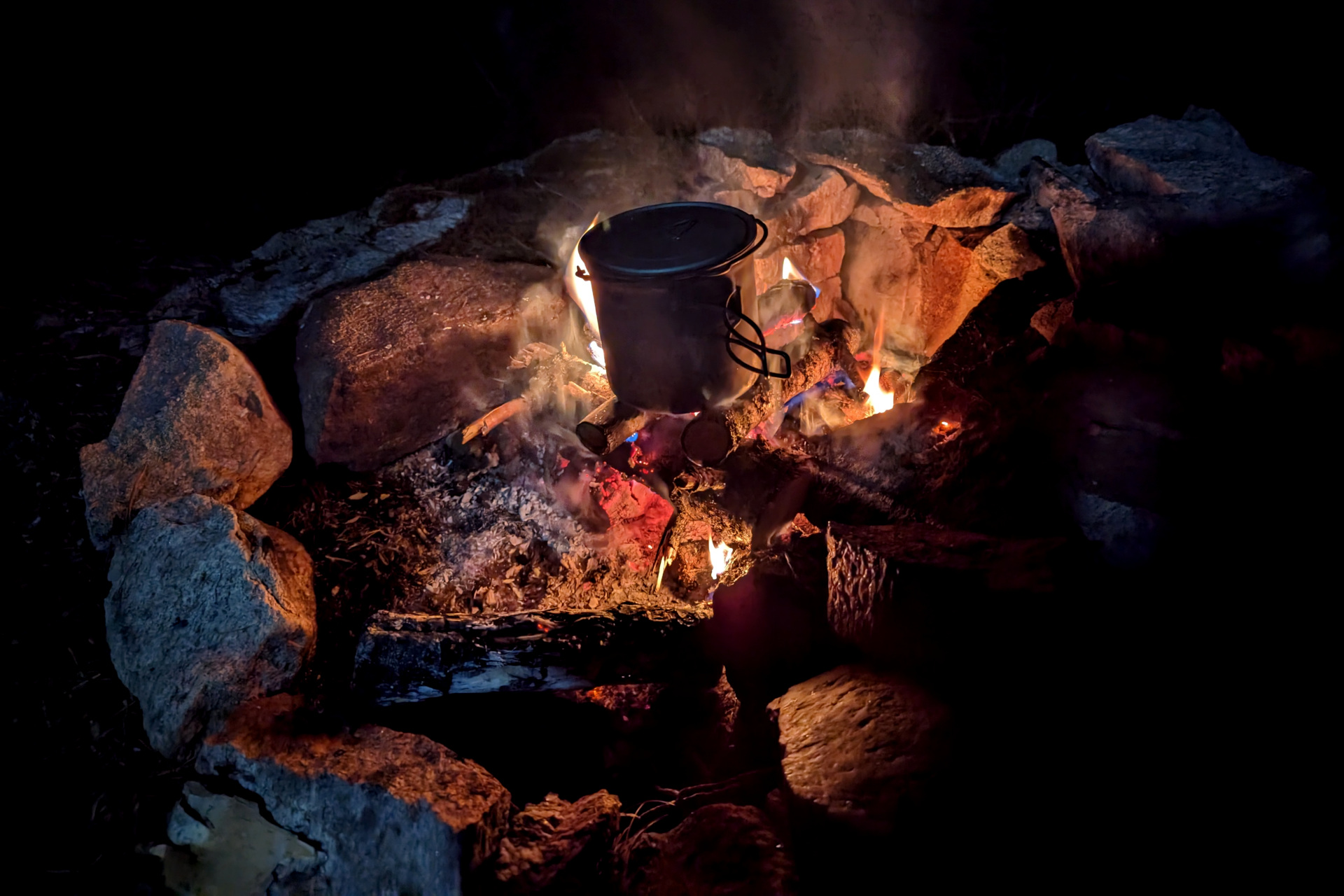
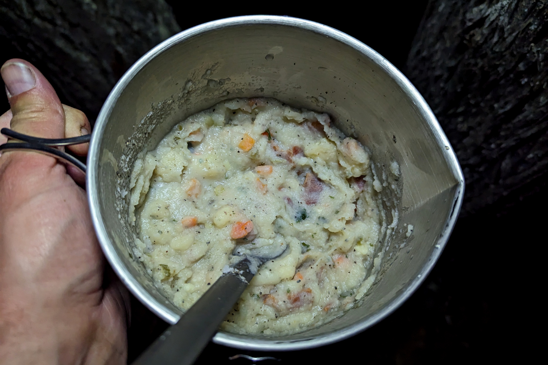
The rest of the night was filled sitting by the campfire and cooking a massive portion of yummy loaded mashed potatoes.
Day 6: Fishing, Backtracking and Swimming
As mentioned previously, my original trip plans had me travelling to Megisan Lake and beyond. Although it was mostly paddling to get to Megisan from Torrance, some of my other target destinations around the lake would require significant portaging and/or wading – something I decided wasn’t a smart idea given the situation with my ankle.
Perhaps that area will warrant a return trip in the future, but for now, I was satisfied with stopping the trip short at Torrance Lake and instead focusing on a day of fishing while I start to backtrack my path and head back down Torrance Lake and the West Aubinadong.
To kickstart today’s fishing, I caught another Lake Trout from camp while making a few casts before heading out after breakfast.
The paddle down Torrance and the West Aubinadong was much easier – and rightfully so I suppose. I’d already gone through the effort of clearing all the portages, marking their access points on my map and taking notes. I was also travelling downstream now and even had a tailwind most of the time! This left plenty of time to stop and fish on the way.
I managed to land and lose several more Brook Trout today, with one particularly nice chunky brookie that was one of my better brookies to date!
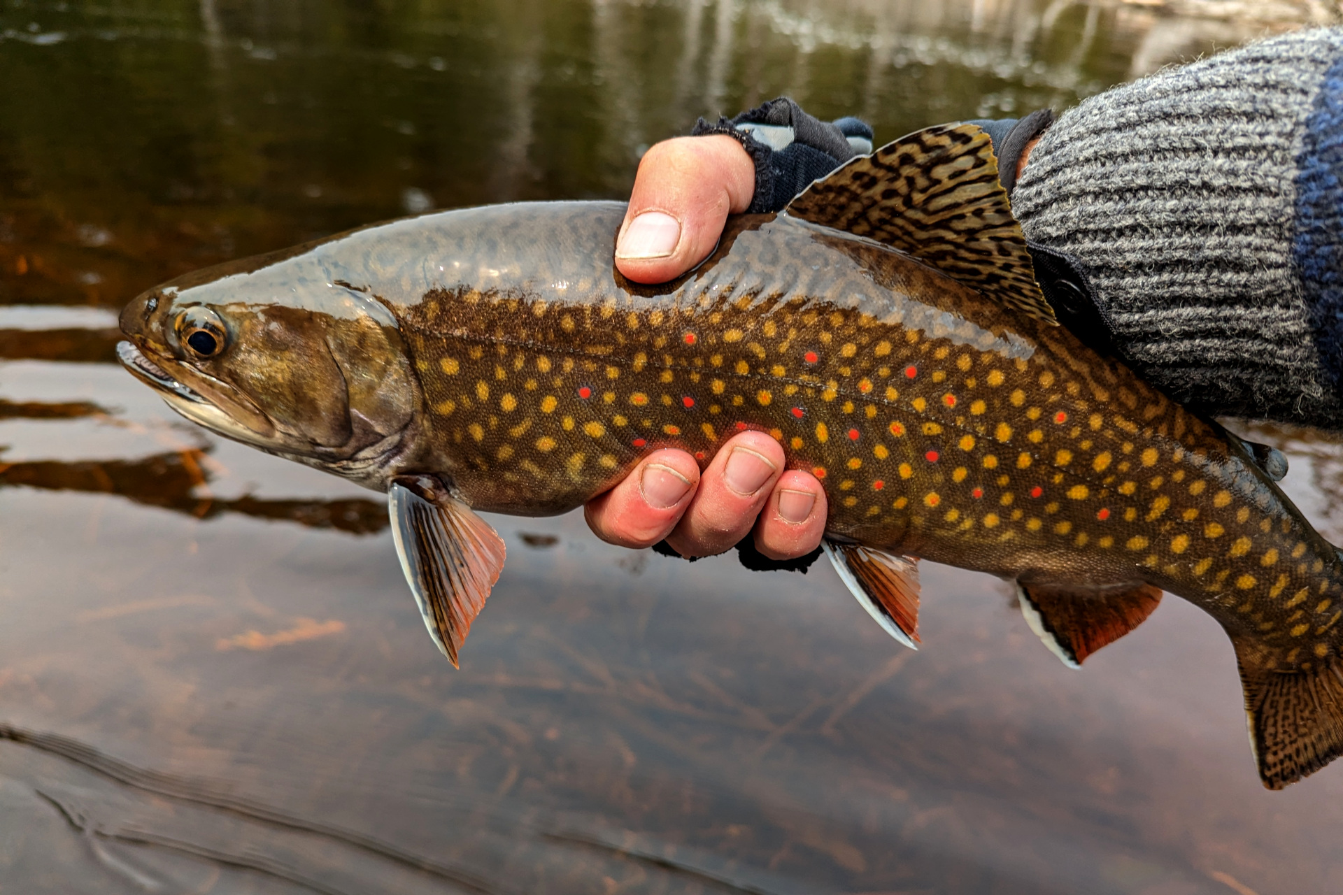
At one particularly nice hole on the West Aubinadong, I cast upstream and had a solid take on my first cast. Another really nice brookie I thought as I fought it to the canoe.
It turned out however, that it wasn’t a brookie at all – but a Walleye.
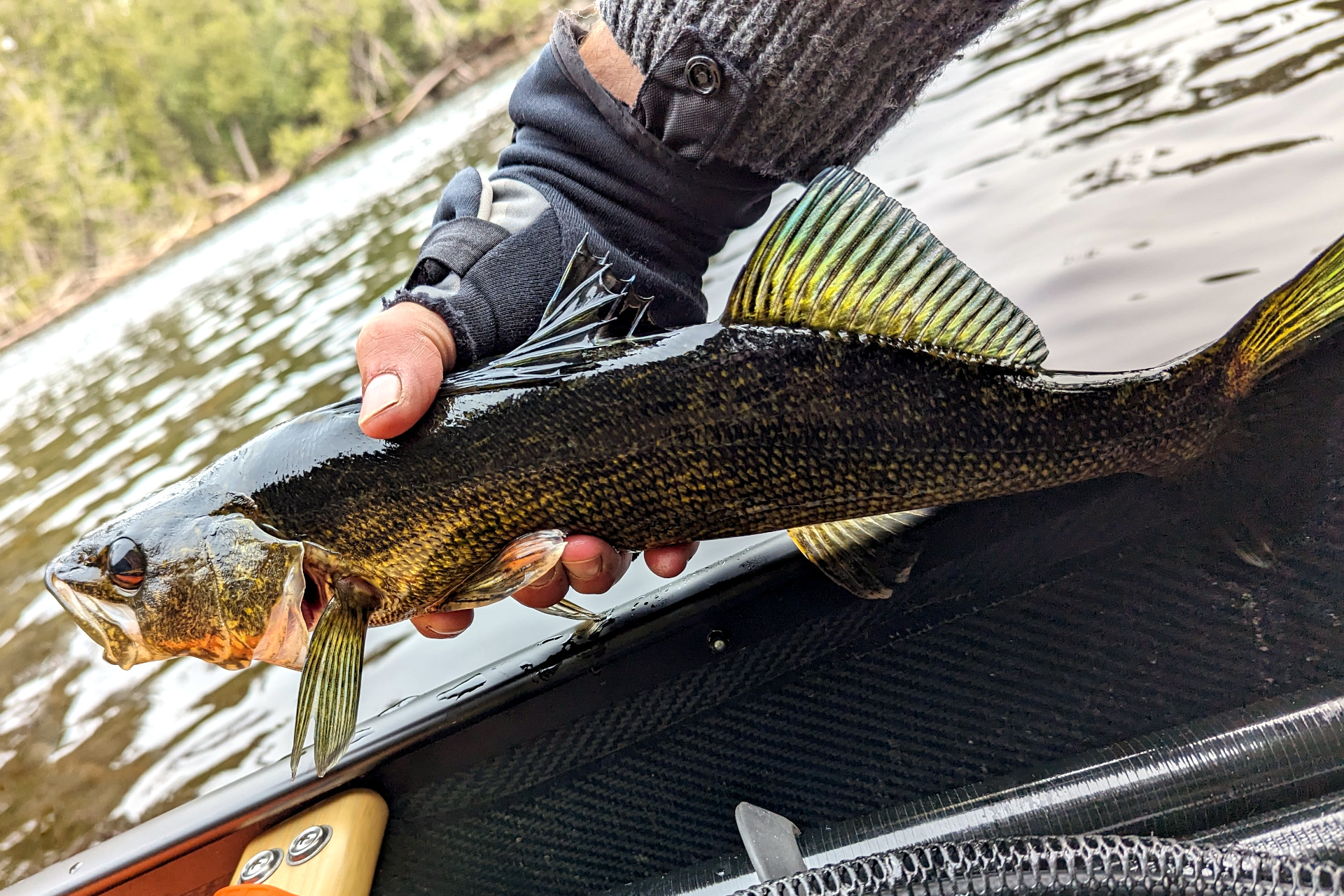
Several more casts produced several more Walleye in the same pool, all around the same size. While catching walleye can be fun, I wasn’t very pleased to see so many in the river. While Walleye and Brook Trout commonly co-exist in rivers in northern Ontario, I imagine these are likely not native to the river and are a large part of the reason why Brook trout are difficult to find on much of the West Aubinadong. I’ve also heard that there is the odd pike in the river as well.
As I continued my travels back downstream, I came across one of the log jams that I’d previously dragged my canoe along the west river bank. It’s a fairly short drag and should have been a quick 30 seconds or so, with the only inconvenience having to get out of and back into my canoe.
However, on one of my steps, I ended up sinking in the river and muck nearly up to my waist! As I was sinking, I fell forward and both arms and some of my chest went into the water. I was wearing a rather heavy wool hoodie, which was now mostly drenched and smelly. To make matters worse, I had my phone (Pixel 6 Pro) in my pant pocket. It’s supposed to have IP68 water resistance, meaning it should withstand a submersion like this. However, it had a small crack on the back glass that, unsurprisingly, compromised the water resistance. Not only was I now drenched, smelly and cold – but my phone’s camera had fairly extensive water damage. I was using the phone’s excellent camera for all of my pictures up until now, so for the rest of the trip, I used my small Olympus TG4 instead. Thankfully the phone’s GPS still worked!
I arrived at the upper Chutes campsite later that evening and setup my hammock as well as a tarp this time, since some rain was forecasted overnight. I also hung my clothes to dry.
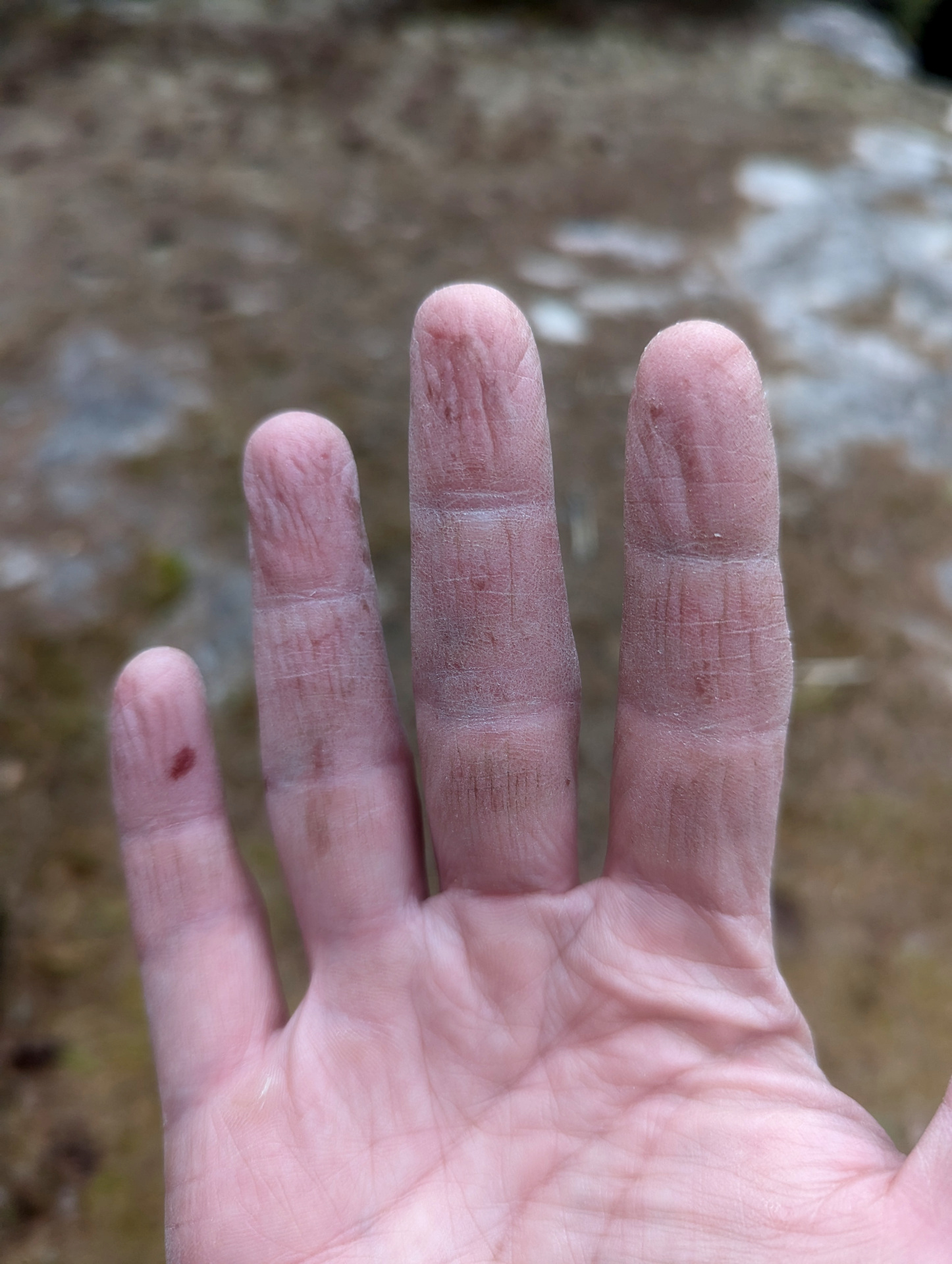
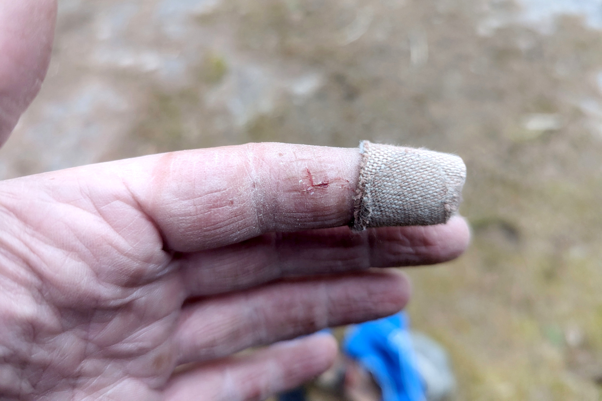
By this time (end of day 6), my hands were extremely dry, cracked and painful. I’d actually made an effort this trip to try and protect them and keep them from getting so bad. But, clearly I didn’t try hard enough and the excessive cold, wet and wind had done a real number on them. I could barely use them for most tasks without a good amount of pain. I obviously need some better gloves next time!
Day 7: Back to Gong
There was light rain when I woke up and it was very chilly. Since I was ahead of schedule (due to turning back at Torrance Lake) and fairly beat up, I decided to stay in my hammock and sleep through the rain. It was 10 am when I finally emerged.
I had quite the mess to clean up at camp from all of my clothes drying and tarp setup, so by the time I ate breakfast, had coffee, took down camp and set off, it was 1:30 – the day was already half over! That’s ok though, as it gave my clothes and gear a bit more time to dry out in the sun and I had no real destination for the day.
In my original trip plans, I had hoped to possibly explore one of the side lakes on my way back down the river, but assuming they would all have fairly rough (if any) portages, I also decided against this due to the ankle. So instead, I could either stay an extra night further down the West Aubinadong, or I would camp on Gong, Mystery or Island lakes – if I make it that far.
I loaded the gear and crossed the river to the portage on the other side.
As I mentioned on my way upriver, this was one of the more rugged portages of the trip. I’d already done the work finding and clearing it though, so it was a good deal easier this time around. I finished the double carry at 2:15.
Aside from a bit of (random) knee pain today, most of the portages went quite smoothly. My ankle held up, I found the portages ok and I didn’t go swimming.
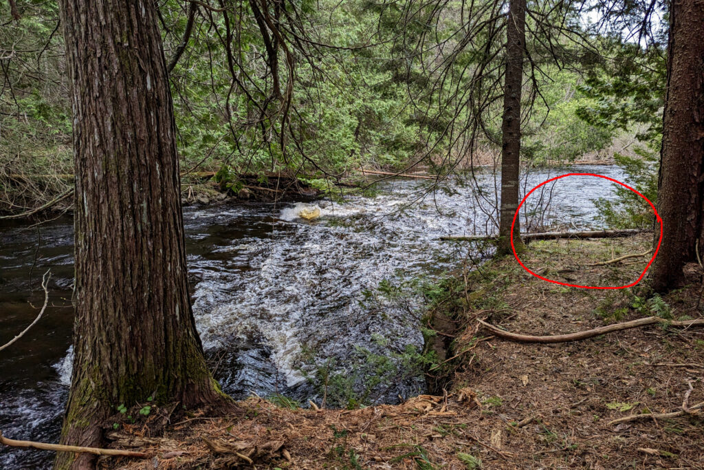
I did have one eureka moment at the supposedly small 30m portage where I had camped a few nights prior – and where the portage worked out to more like 200+m. As I loaded up my canoe and gear at the take-out, as I was about to head up the portage trail into the forest, I noticed a small put-in at the downstream side of the campsite. So that is the why the portage was marked as only 30m! I scouted the river between this put-in and the put-in that is much further downstream, and it does indeed seem navigable (with some required wading when travelling upstream). Next time!
As is usual after rainy weather, the winds were low and the water was calm for the rest of my paddle down the West Aubinadong.
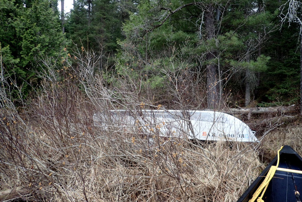
At one of the widenings of the river, I noticed what looked like an opening in the forest on the far bank. There also seemed to be what looked like a stashed boat there. I paddled over to take a look and indeed there was a stashed boat and portage / trail. This must be an access point from another trail or forest/ATV road.
It was about 6 pm when I reached the southernmost campsite on the West Aubinadong. I needed to make a decision whether I would camp at this site, or continue to either Gong Lake or Mystery/Island Lakes. There weren’t many portages between here and those destinations – and considering how well the day was progressing, I opted to continue paddling downstream towards Gong Creek and Gong Lake. For the umpteenth time though, I should have known better and just stayed at this campsite…
The rest of the paddle down the West Aubinadong and the first section of Gong Creek was uneventful.
Getting Lost at a Portage
I was making good time up until the point that I reached the first portage from Gong Creek to Gong Creek (where the put-in/take-out is directly below some rapids).
There is a rough forest road here that I somehow didn’t remember from the first time I did this portage. The problem was, I didn’t see any other portage trail. I must be getting old – either that, or there were just far too many portages on this trip – because I completely forgot what this portage looked like at the beginning of the trip. All I remember is it being uneventful, which was reinforced by the fact that I hadn’t taken any notes about it.
I looked around for a bit, at a couple spots that looked like possible openings, but couldn’t find any portage entrance that wasn’t the road. So… I set off up the road, wondering if maybe the portage entrance was up the road somewhere, or if I’d simply completely forgotten taking the road in the first place!
This road went almost straight uphill for quite a ways and I huffed and puffed carrying all my packs up it. I got close to 500 meters down the road before checking my GPS location and bearing and deciding that there’s no way this is the portage, as it was heading in the wrong direction. So back I went, down the hill to the portage take-out. I spent another 10-15 minutes looking around to no avail. I was completely dumbfounded… how could I possibly not be able to find this portage? Eventually I gave up again and second guessed whether perhaps the road eventually turns towards the correct direction.
So back uphill I went, STILL with all my gear on my back (I’m not sure why I didn’t drop everything when I started this whole ordeal). This time I walked even further up the road, despite knowing there was no way this could be the actual portage, until once again turning around and heading back to the take-out.
I dropped all of my gear this time and told myself I wasn’t leaving this spot again until I found the real portage. Literally seconds later, as I was taking a break and casually peering along the river bank towards the road, I noticed the smallest of openings through the foliage into the forest. I’d somehow managed to miss this small opening up until now – which indeed turned out to be the portage trail!
I ought to be ashamed even admitting this ridiculous set of events, but you need to be able to laugh at yourself sometimes (and I certainly did after all that)! I must have trudged out of that opening on my trip up, straight to the river without looking at my surroundings. Lesson learned.
It was already 8:40 pm when I finished this portage and I still had a couple kms of creek paddle left, along with one more portage from Gong Creek into Gong Lake and finally 3km of paddling on Gong Lake to reach a campsite.
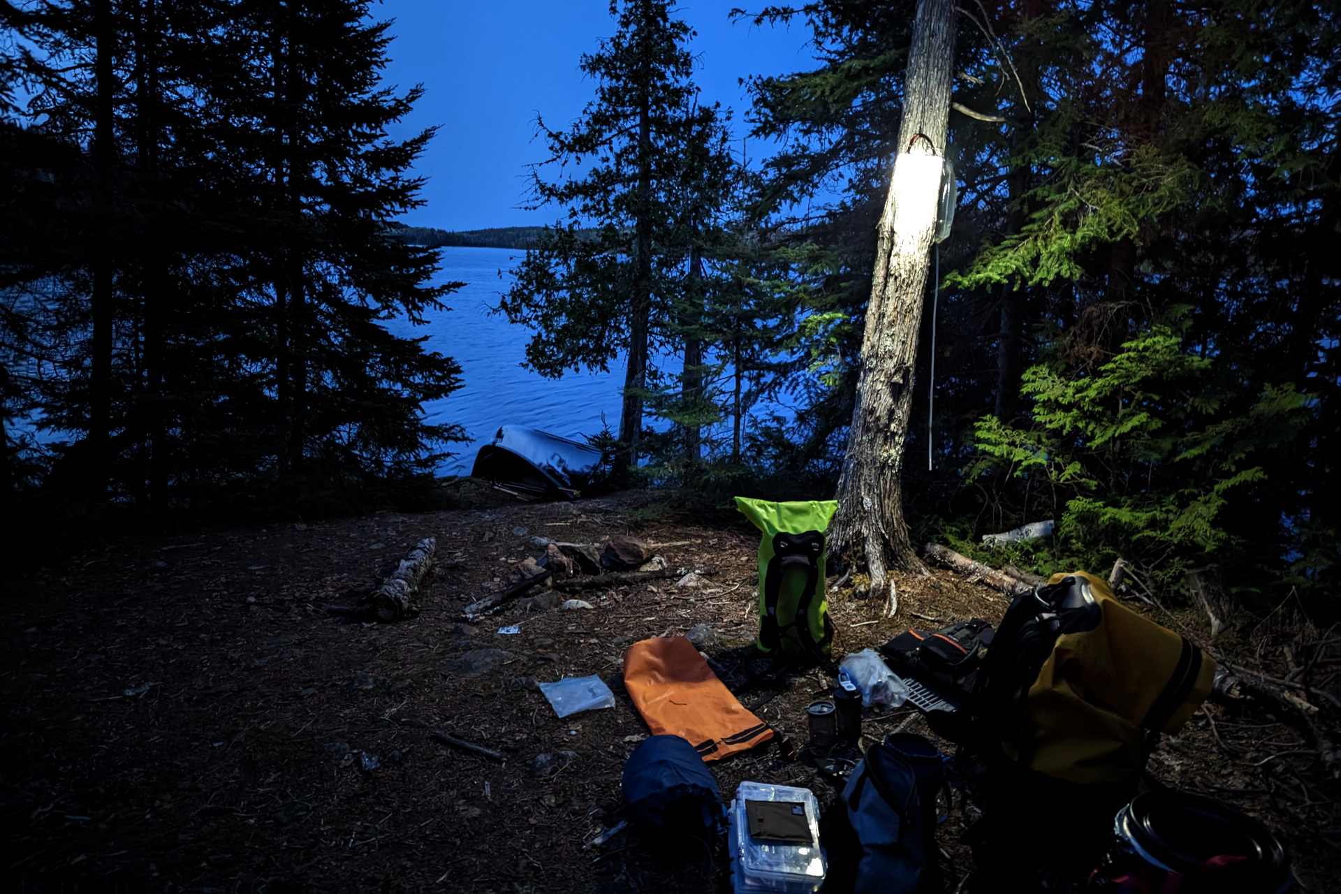
Suffice it to say, it was nearly 10:00 and pitch dark when I finally reached my campsite on Gong Lake. Thankfully I knew where I was going from the trip in, otherwise trying to find a campsite in the dark would not have been fun!
That evening was a quick hammock hang, rehydrated meal dinner, then to bed.
Day 8: Long Haul Home (24 hours later)
I didn’t yet know what today would bring. On my first day, I had planned to make it from Ranger Lake to Island Lake (which is less distance than where I currently was to Ranger Lake) – but I wasn’t even close to accomplishing that thanks to the headwinds. Today was somewhat windy, but most of it was not headwinds.
Although I wanted to stay on Island or Mystery Lakes (and still hadn’t), that didn’t seem to make much sense given I had stayed on Gong Lake the night before. That would have meant only about an hour of travel for the day. When doing a non-loop trip – and especially after this one, where I had a couple injuries and generally expended tons of energy and got beat up pretty good, I was ready to make some distance and ensure I could get back to my truck in at most 2 fairly easy days.
After breakfast, I fished for a bit from camp, then packed up and was at the Gong to Mystery portage by around 11:00. I made quick work of that portage then trolled while I slowly paddled both Mystery and Island Lakes.
I started the long 3km portage (double carry) from Island Lake to Saymo Lake at around 2:30 pm, this time without any help. It was a nice temperature today and there were still NO bugs at all – which I suppose is a big advantage of tripping a bit more north at this time of year. Algonquin on the other hand, would almost certainly be well into black fly season by now.
It was just after 5:00 pm when I arrived on Saymo Lake. I was strongly debating staying at the same campsite here that I did on my first night, as it was a nice spot. However, Saymo was unusually calm, or so I thought, especially given how windy it was earlier in the day. I also had a bit of a tailwind, so I instead decided to take advantage of this and attempt to paddle all the way back to Ranger Lake. I could then decide whether to camp on Ranger Lake, sleep in my truck, or drive home.
For about the first third of my paddle down Saymo, I trolled the shoreline and I got into a good number of lake trout. I seemed to have finally dialed in the depth, speed and structure to look for when trolling (at least for this time of year). Once again, I was pleasantly surprised by Saymo.
Unfortunately, when I passed one of the points on Saymo and got into more open water, I quickly recalled the difference in roughness between the northern arm of Saymo and rest of it. Winds picked back up and the waves were quite big. This meant an end to fishing and time to focus on paddling.
The wind also started to shift direction, meaning I was now dealing with a fairly strong side wind – and at times a headwind. After battling some pretty intense winds and waves while coming around a large island point, I stopped at a nice little beach campsite to take a quick rest.
The lake calmed down a bit as I approached the Ranger Lake portage. When I finished the Ranger Lake portage (my last of the trip), it was 7:30 pm – plenty of time to make the final 4 km paddle south on Ranger to the access point.
I didn’t expect conditions on Ranger to be nearly as bad as Saymo – and those expectations held up for the first half of the paddle.
Just as I thought I was home scot-free, Ranger Lake had one last challenge to throw my way. As I entered the second half of my paddle and the lake opened up a bit (red section of the route on the map below), I was hit with some large breaking waves, that were often coming from two different directions.
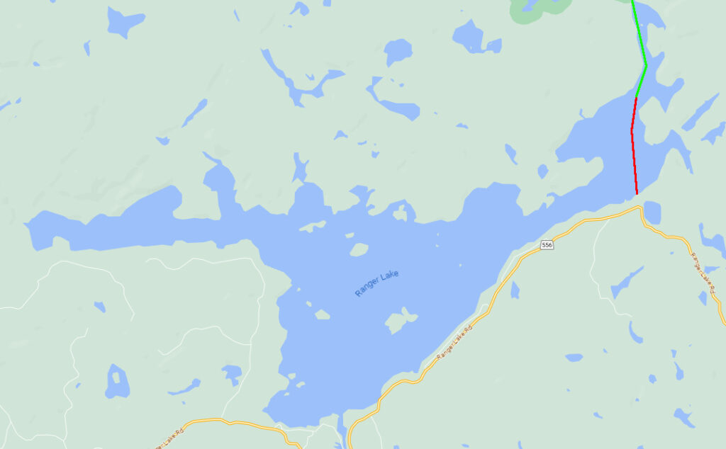
The paddle from here to the access point, was one of the longest 2km of paddling I can ever remember. I was very close to having to pull over and wait out the wind (or camp on the side of the lake in thick bush). If I wasn’t paddling the prospector, which is excellent in rough conditions, I definitely would not have been able to continue.
At one point, as I zig-zagged and bounced up and down while maneuvering my canoe through the difficult waves, a fishing boat slowed down and the two guys on board carefully watched me for most of the rest of my paddle. It seemed like they were on the verge of coming over to check on me – and although they didn’t, I assume they were keeping an eye on me just in case.
After a white-knuckled paddle, I arrived back at the access point at 9:00 pm, after approximately 10 hours of travel! The only thing left to do now, was pack up the truck and decide whether I’d sleep there, or attempt a long drive home in the dark. You’d think I’d be exhausted after the long day – and I was… at least until the intense paddle at the end of it gave me an extra jolt of energy.
The next day (Sunday) was my son’s birthday, so I decided to do the drive now while I was awake and try to make it home. If I got too tired, I’d pull over at one of the many hotels along the Trans-Canada highway. That never did become necessary and I was home at 6 am Sunday morning – almost 24 hours after waking up and starting my day on Gong Lake the day prior! That was some serious distance covered in a single day!
Final Thoughts
I wasn’t sure how challenging this trip would be when I planned it. I knew it wouldn’t be easy, but I would definitely say it was a bit more challenging than I thought. The cold, amount of gear / double carries, injuries and difficulty finding portages were the major factors – though the upstream travel at times, along with some rough lakes and headwinds contributed somewhat. It was definitely a memorable trip though!
As is often the case, I would have liked to spend more time fishing, but that’s typical for me when travelling an area for the first time – which tends to be filled with more exploring than fishing. Trolling more this trip definitely helped fill some of that gap though and I did catch decent numbers of both brook and lake trout.
The weather overall, while slightly below seasonal averages and cold at night, was very nice. Over 9 days, I had only about 4 hours of rain! There were also no bugs the entire trip!
I hope to return and spend more time exploring and fishing areas I didn’t get a chance to – especially now that I’ve captured some detailed notes and coordinates that would help make this a smoother trip next time.